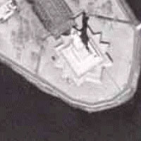
Satellite image of the Statue of Liberty, Ellis Island, New York.
RESTON, Va., Nov. 3, 2000 — A little over three years ago, Tom Barclay and Jim Gray were presented with a challenge. The SQL Team at Microsoft needed to test its newest version of SQL Server — SQL Server 7.0 — in a real-world setting. Barclay and Gray knew the project would need to be larger than anything that had been done with Microsoft technology prior to that time, and it would have to include data that would interest virtually everyone if it were going to be used over the Internet.
The answer? The TerraServer, an online database like no other, composed of satellite images of Earth. The size? Over 10 terabytes — 10,000 gigabytes — of raw data, making it 10 times larger than any Windows NT and SQL system ever before assembled. Working with U.S. Geological Survey (USGS) data, Gray and Barclay assembled the Web site and have been operating it for over two years.
Today, Barclay and Gray will receive the
“Year 2000 John Wesley Powell Award”
for their work on the TerraServer project. The award is the U.S. Geological Survey’s most prestigious honor for non-USGS employees.
The award recognizes an individual or group, not employed by the USGS, whose contributions to the agency’s objectives and mission are noteworthy. The award, first given in 1971, is named for John Wesley Powell, the distinguished scientist and explorer who served as the second director of the USGS from 1881 to 1894, and who made the pioneer exploration of the Colorado River.
“It’s an honor that (the USGS) has chosen to bestow this award upon us,”
said Barclay, program manager at Microsoft Research’s Bay Area Research Center (BARC).
“The TerraServer project has been a fascinating and productive partnership, and I’m looking forward to continuing it.”
The TerraServer project began in late 1997 as a collaborative effort among the USGS, Microsoft Research, Compaq, Aerial Images Inc., and several other organizations that shared the objective of building the largest database on the Internet, one of unprecedented scalability. The TerraServer stores topographic, aerial and satellite images of the Earth in a SQL Server database and delivers those images to the public via the Internet.
The TerraServer is so massive, it would take 5,075 CD’s — or a 169-foot stack of jewel cases — to house the 3.5 terabytes of compressed data currently loaded on the database. Soon, Microsoft will be unveiling the next generation TerraServer, which will take the work to a whole new level.
The working relationship that developed during the TerraServer project has proved to be one of the most fruitful that Microsoft has had with any government agency. The project was scheduled to last two years, but according to Barclay,
“It was going so well that we all decided this year that it would be best to extend the timeline for another 2 1/2 years.”
“The USGS partnership with Microsoft demonstrates public-private collaboration at its best,”
said Hedy Rossmeissl, senior program advisor for Earth Science Information Management and Delivery at the USGS.
“Because of the database and software expertise of Dr. Gray and Mr. Barclay, the general public gains a seamless view of two national datasets produced by USGS, digital orthophoto imagery and digital topographic maps. Without this collaboration, the maps would still only be available in traditional paper and digital formats. We are very glad to be part of the TerraServer project.”
Taking the plunge into the TerraServer project was a logical step for Barclay and Gray, because of their research on large spatial databases and their quest to build an inexpensive terabyte that would give people the ability to store all of their documents, audio and video in one place. TerraServer quickly exploded in popularity, and now receives over 50,000 visitors per day, ranking among the world’s top 1,000 Web sites.
“At this point, we have served over 2 billion Web hits and 20 terabytes of geospatial images,”
said Gray, a Microsoft Distinguished Engineer.
Because the project used real data, it forced Barclay and Gray to enlarge the project team beyond database and systems researchers. By including additional companies and organizations, the project goals and requirements expanded.
“This project is a poster child for collaborative research for several reasons,”
Gray said. The project brought people with additional skills to the table such as geographers, graphics researchers, GIS experts and others.
Barclay added,
“It was only then that we were able to blend the knowledge and skills of diverse partners to build a powerful spatial data warehouse and produce a more complete result by solving a wider set of problems than just a database or operating system problem.”
In addition to scalable servers, BARC concentrates on telepresence — techniques that allow someone to be
“present”
at an event while physically being some other place (space-shifting), or at some other time (time-shifting). The lab currently has five employees and hires interns and contract workers when the need arises.
“As we’re making new discoveries and doing great research, I think we’re looking at a long-term relationship. What we are learning here will ultimately mean more data management capabilities, for both enterprise customers and consumers in the future,”
Barclay said.


