
Editor’s note, Jan. 27, 2010 –
A reference to Microsoft’s work with ESRI on Fusion Center was updated post-publication.
REDMOND, Wash. — Jan. 27, 2010 — When Microsoft CEO Steve Ballmer spoke at the 2010 International Consumer Electronics Show in Las Vegas earlier this month and demonstrated the breadth of new information devices now becoming available, most people in the audience thought about music, movies or games. But for Tim Bloechl, managing director of Public Safety and National Security for Microsoft, the speech presented both an opportunity and a challenge.
“When my father was a career police officer in Oshkosh, Wisconsin, his only means of communication were a two-way radio, police call boxes or public telephones and paperwork,” says Bloechl. “Today when officers arrive on scene, they have radio, cell phone, video devices, and quite a few police forces have laptops in squad cars and even GSM tracking devices. The more information police have when responding to incidents increases their situational awareness and improves command and control of these operations. However, in a world where first responders have to make split-second, sometimes life-and-death decisions, making sure they are receiving the right information at the right time is crucial.”
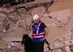
Gisli Olafsson, a disaster management technical advisor for Microsoft’s Global Strategic Accounts team, is leading Iceland’s Urban Search and Rescue team, the first international rescue group that touched down in Haiti.
This week, Microsoft’s Ballmer is at the Worldwide Public Safety Symposium in Redmond, Wash., coming together with Bloechl and Microsoft partners from around the world to discuss ways that the company’s innovative technology and vast partner ecosystem will tackle the 21st century’s five core emerging public safety technology trends: changing user interfaces (UI), cybersecurity, unified communications, cloud-based access to large volumes of information, and use of social media technologies to support public safety.
Each of these trends brings its own set of opportunities and challenges. But a common element is the need to get the right information quickly and to manage it in an efficient manner. The information then needs to be culled for the most relevant details, and then shared quickly with all relevant parties.
Building on Existing Technologies and Relationships
Many of the technologies that people use in their everyday lives today can be taken one step further to enhance and manage the information that helps public safety professionals do their job.
Soon, a police officer could pull up to a suspect vehicle, take a picture of its occupants, and then scan it into a database. The database could use facial recognition and automatically pull up any criminal history, warrants or stolen vehicle data. The officer could know in seconds if anyone in the car was wanted for a crime, information that might lead him to change his approach to the car.
Next, that information could be passed to a police station before booking. And evidence such as the recording of the traffic stop from the officer’s squad car could become part of one digital file, providing a data-rich record of events that follows the suspect through the judicial process.
Knowing the technologies already exist, turning this scenario into reality is a matter of getting the capabilities to the right people and making the solutions affordable for cash-strapped governmental agencies. Then officials need the right analytical solutions to aid all the agencies involved to share data and see it in a way that is useful.
One partner Microsoft has been working with in this area is ESRI, a company that specializes in Geographic information system (GIS) technology. Together they have created the core technology behind Fusion Center, which has capability to enable police, along with counter terrorism and intelligence agencies to share real-time data, collaborate, and display information visually on interactive Bing maps and SharePoint-based tools using ESRI’s secure ArcGIS servers. Importantly, this capability is designed to be fully scalable so it can be deployed by the smallest of agencies at low cost, but also be capable of meeting the needs of large federal agencies.
Applying Lessons From Today for Tomorrow’s Disasters
The earthquake disaster in Haiti demonstrates the need to have this information in hand as quickly as possible. Since the Jan. 12 quake that has killed at least 150,000 people, aid has rushed in from all over the world in many forms. Beyond monetary contributions, Microsoft has played a role in providing technical support. For example the NetHope Haiti Emergency Center uses a secure Microsoft SharePoint application for all its members and serves as a focal point for all reports, events, contact lists and collaboration.
Another critical piece involves mapping — assisting in identifying areas of extreme damage, impacts to critical infrastructure, areas suitable for food and water distribution, and more. This is an area where partners like ESRI can help, giving officials critical information used for making all types of decisions.
“Our job is to help where we can empower our users with better GIS support,” says Russ Johnson, director of public safety solutions for ESRI. “As soon as we learned of the terrible event in Haiti, we activated our emergency operational procedures to assist emergency services, humanitarian relief, health professionals, NGOs (nongovernmental organizations) and others. These organizations are working extremely hard to make a difference. We’re working to assist their efforts.”
During this week’s symposium, Microsoft, ESRI and many other partners are sharing what they and their partners are learning in Haiti. The goal: Take these lessons and apply them in ways that facilitate collaboration and information sharing and help others build joint strategies for the future.


