

By Jason Hermitage – GM Public Sector, Microsoft Canada
Digital transformation is providing organizations with not only information that was never thought possible, but information that is accessible and usable. Data is the foundational resource that allows organizations to transform and uncover the insights they need to make smart decisions.
And this transformation is no different when the organization is the Government of Canada.
In July of 2018, StatsCan and Microsoft collaborated in order to tackle a unique challenge for our vast country. Together, by leveraging AI, they developed a solution that will help all Canadians.
Using’s StatsCan’s Open Database of Buildings which is generated from municipal open databases, along with satellite and aerial imagery, coupled with Bing Maps’ significant investments in the areas of deep learning, computer vision and artificial intelligence, Microsoft is strengthening Canada’s census with smart data and a better understanding of where people live. This is done by mapping the footprints of every building in the country. We are releasing more than 12 million building footprints in Canada to the OpenStreetMap community.
When you know where the buildings are, you know where the people are. Accounting for this has always been a great challenge for governments, as well as humanitarian efforts and philanthropic initiatives. By putting people on the map, everyone can have access to services that we can sometimes take for granted.
As open data, the map of building footprints will be available to all Canadians looking to better understand their country. Building Footprints allows for integrating open data from municipal, regional, and provincial governments to meet the needs of official statistics. A better understanding will allow for better decision making across all sectors, both private and public.
Microsoft Building Footprints is more than simply outlining the buildings that exist along the roads on a map. These building footprints identify the buildings you didn’t know were there, on the roads and pathways that don’t appear on maps and don’t connect to any known road networks. By using satellite and aerial imagery, Microsoft was able to look for the stuff that maps didn’t know existed. And by relying on imagery that is constantly being updated, new construction is quickly added to the database, unlike traditional mapping that will never catch up as new shovels hit the ground every day across the country.
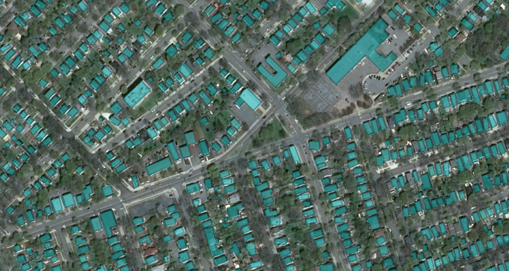
In order to identify every single building in Canada, from coast to coast to coast, through machine learning, the solution was able to identify shapes, learn which were buildings and then convert everything to geometry data that is easily processible for geography applications. Canada is only the second country where Microsoft has undertaken this initiative after the U.S. and the machine had to relearn and adjust for Canada’s vast rural, agricultural and differing landscape and biomes. With adjustments along the way, the whole process took approximately four months to map every building.
Now that it is live and open to everyone, we are proud to have been part of this massive open data initiative that helps Canadians and ensures that everyone is counted. And we are excited to see what happens next as governments, businesses, NGOs and academic institutions take advantage of what we have learned.
Learn more about this initiative by clicking on our GitHub or Statistics Canada site.


