In collaboration with Microsoft, Manaaki Whenua – Landcare Research (a New Zealand Crown Research Institute) will begin an initiative to develop improved detection of land use and forest cover change. These are important elements in the assessment of carbon stored in New Zealand forests and improved mapping will help inform decisions and policies for a more sustainable Aotearoa (New Zealand).
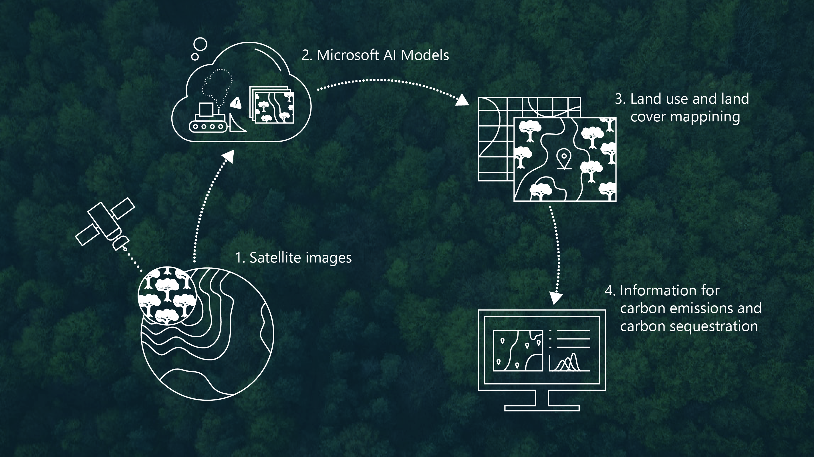
This initiative will tackle environmental issues utilizing satellite data, high resolution imagery, AI, and analytics to create a clearer picture of our changing land environment. Microsoft’s AI for Good team will work with Manaaki Whenua’s Remote Sensing team to develop models and methods that can assess and monitor changes in land use and land cover at scale, using high-resolution satellite imagery including datasets from the Planetary Computer. These new mapping approaches can be coupled with other carbon models to monitor changes in carbon and help policymakers, urban planners and the general community consider how we utilize the land in relation to the impact of New Zealand’s climate change goals.
“The data from this initiative will have practical applications related to understanding changes in carbon sequestration – the process of capturing and storing carbon dioxide from the atmosphere,” said Juan Lavista Ferres, Chief Data Scientist of Microsoft’s AI for Good program.
Additional collaboration with Manaaki Whenua and Microsoft along with other partners, enterprises, and local communities will be to develop research that supports government decision-making and policies related to the care of the land and climate change.
“Aotearoa New Zealand has ambitious goals to address climate change and meeting those goals will require many partnerships and collaborations”, said Fiona Carswell, Chief Scientist of Manaaki Whenua. This project with Microsoft is a strong example of working together to enrich our understanding of te taiao (our environment) today and for our future.
As data become ever more available at increasing resolution and frequency, techniques like AI and deep learning open new possibilities for monitoring our environment by mapping and measuring the natural world more frequently, and with greater accuracy and confidence. This project is an important step toward realising this aim.