CSIRO wields data and AI as sword and shield to protect the planet
![]() Microsoft News Center
Microsoft News Center
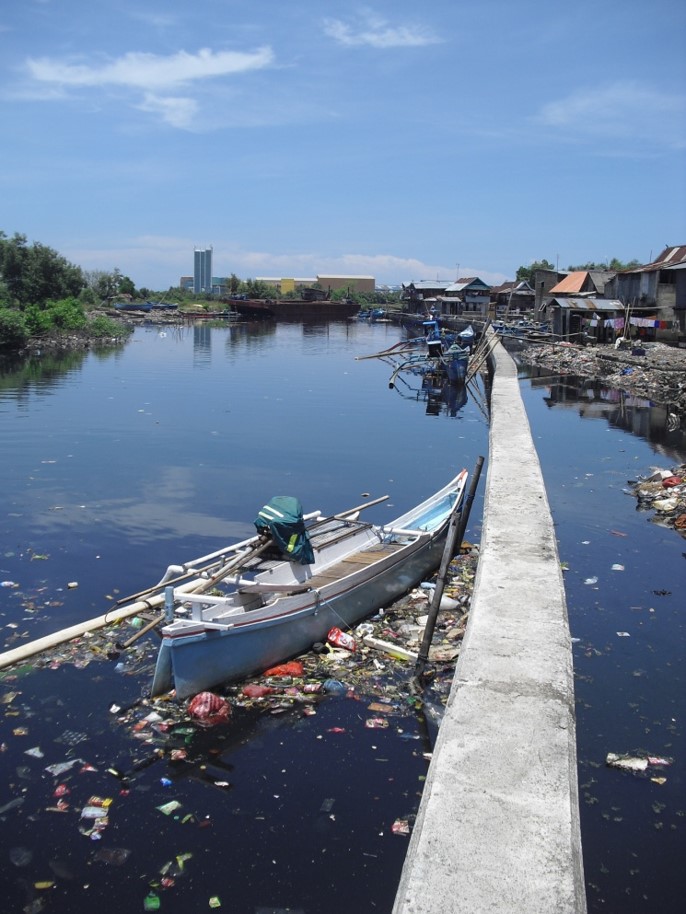
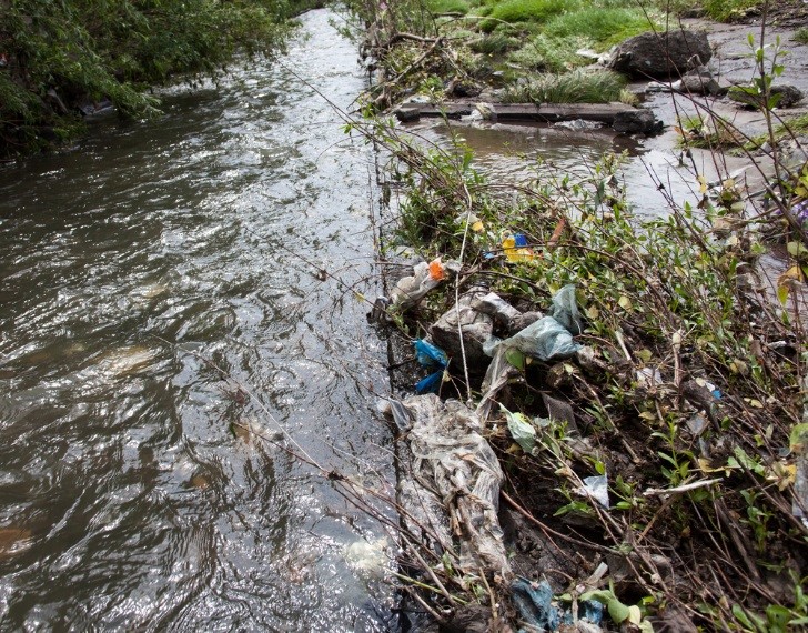
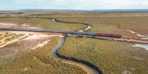
A walk along a wide, deserted beach – no car, house, nor other person in sight. The southerly whips up the sand, needling against your leg. You glance down and nestled in the shells and seaweed is a blue clip, a shred of ribbon and the remains of a long-forgotten balloon.
You may collect your “three for the sea” every time you venture out for a walk, but plastic pollution remains a major global concern – it’s estimated that as much as 12 million tons of plastic finds its way into rivers and oceans each year, representing a huge threat to wildlife and the environment.
It’s one of the major challenges that Australia’s national science agency CSIRO is seeking to address. It is using leading-edge technologies to interpret data collected during beach and ocean surveys along with videos of rivers and stormwater drains to identify and track garbage flows into waterways and inform intervention efforts, like placement of river rubbish traps and paid deposit schemes.
According to CSIRO principal research scientist, Dr Denise Hardesty; “This is some of the most exciting research I’ve ever had the opportunity to do.
“People care about the plastic pollution issue. It’s something that resonates with people whether its industry, governments, private citizens.
The science that we are carrying out is answering people’s questions on how we – all together – can help resolve the plastic pollution issue, she says.
The project is one of several being undertaken by CSIRO using artificial intelligence and state-of-the-art digital technologies as part of a new partnership with Microsoft which is intended to help address some of the most challenging issues facing the world today.
Dr Hardesty’s research is focussed on tackling the spread of marine debris because it can pose navigation hazards, smother coral reefs, transport invasive species and negatively affect tourism. Marine debris also injures and kills wildlife, has the potential to transport chemical contaminants, and may pose a threat to human health.
By collecting data about the spread and concentration of plastic Dr Hardesty and her fellow researchers are using machine learning and AI to analyse where the plastic might end up, and also what steps could be taken on land to reduce the likelihood of plastic entering waterways and oceans.
Applying Microsoft tools to our research methodology will improve our understanding of what, where, how and why plastic pollution ends up on land, along our coasts, and in the ocean. says Dr Hardesty.
“We will be able to count and track plastic debris and conduct quantifiable assessments of the effectiveness of waste management programs, and evaluate intervention efforts.”
Microsoft digital tools will significantly improve the team’s current method of data collection using hand-written datasheets. By leveraging Microsoft Custom Vision, plastic debris in marine environments can be counted much faster and can be used in areas that are unsafe for manual collection and counting.
Evidence based research
According to CSIRO chief executive Dr Larry Marshall, the partnership with Microsoft brings together decades of scientific expertise in solving real-world challenges with the latest in AI and digital technology.
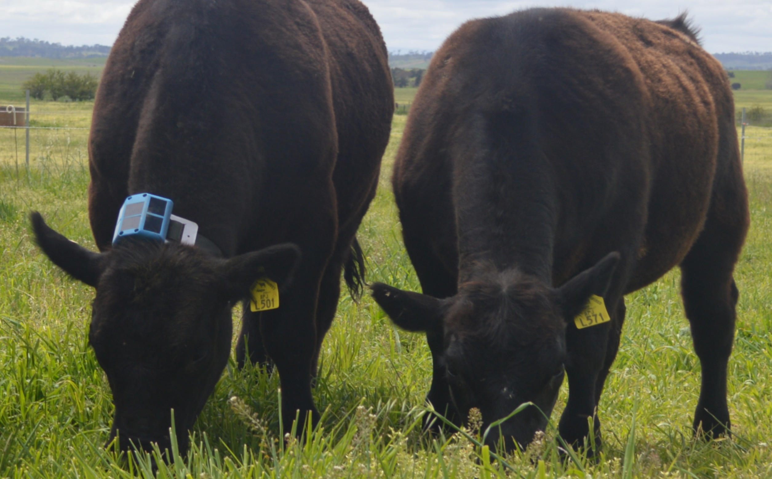
“We already have evidence that this approach can be highly successful,” says Marshall. “CSIRO has been working with Bininj co-researchers, Kakadu National Park rangers, Microsoft, Parks Australia, Northern Australia National Environment Science Program, University of Western Australia, Charles Darwin University and Kakadu National Park weaving together AI-driven software with traditional knowledge to solve complex environmental management problems and care for significant species and habitats.
“Combining Indigenous knowledge, AI, data visualisation and scientific research has allowed researchers and Indigenous rangers to label and interpret drone footage, gathered from across Kakadu and then use that to help protect the environment.
“The results and analysis are then made available to rangers through a dashboard designed in partnership with the Traditional Owners based on their cultural values and the season. Rangers access this on a mobile device to support their on-the-ground decision making in partnership with Traditional Owners. It has resulted in a return of magpie geese to one area which had been affected by an invasive grass species that has now been reined in.”
The partnership with Microsoft will also support CSIRO in tackling other major global challenges.
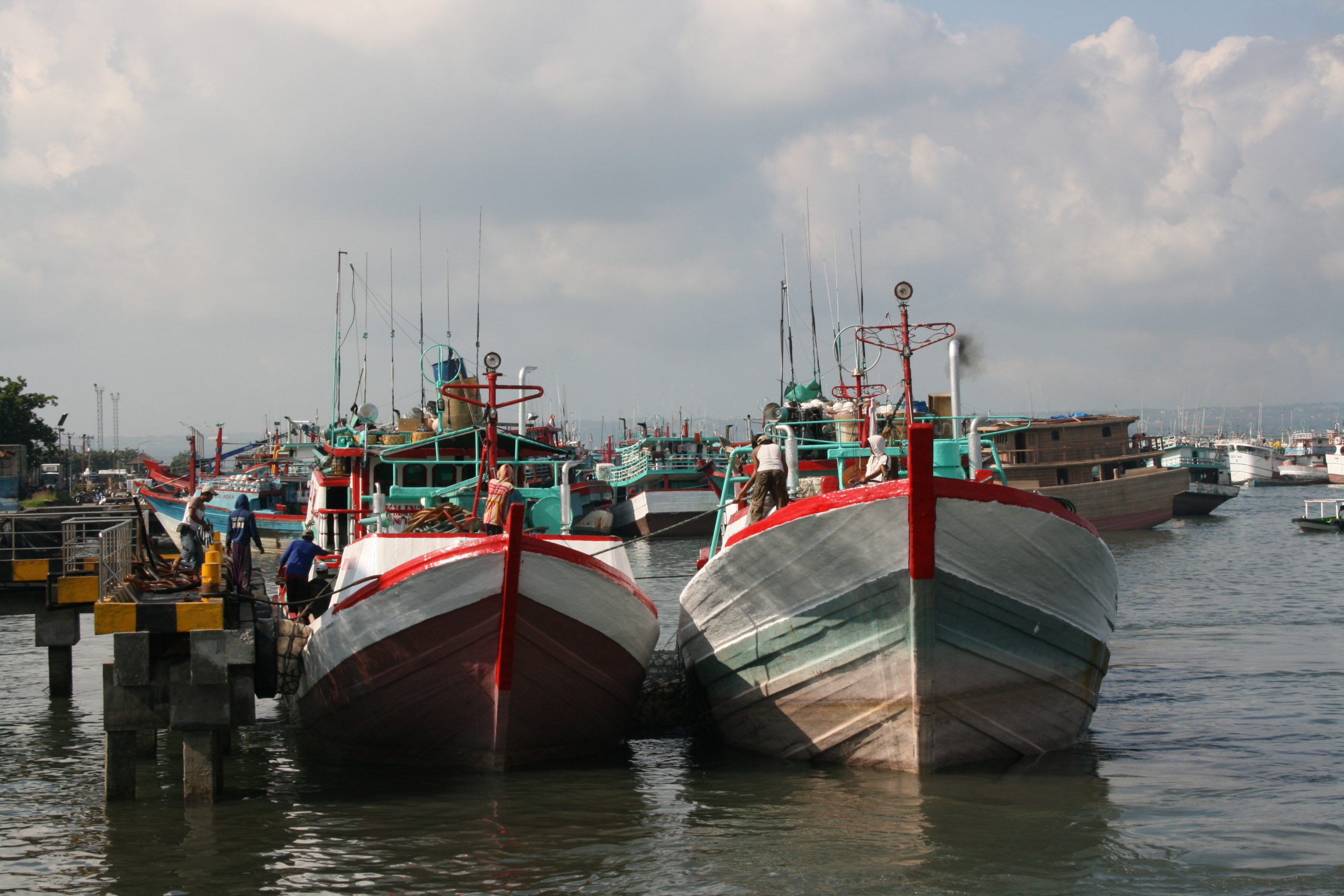
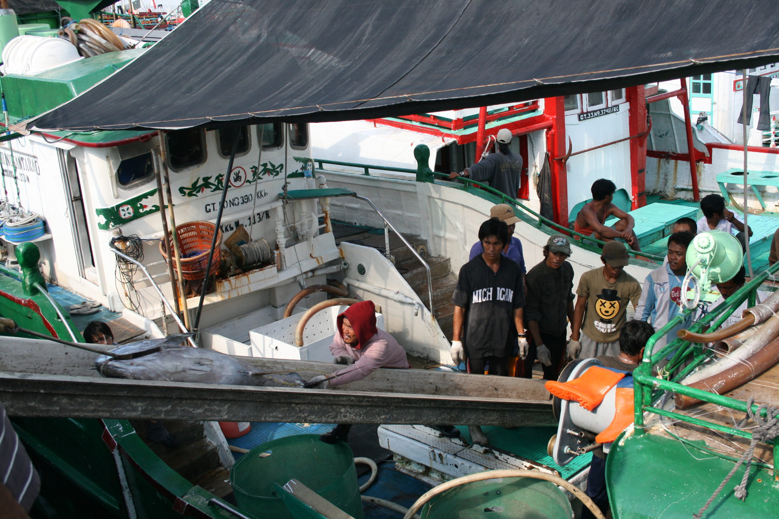
For example, the vexed issue of illegal fishing. Fishing is an important source of food, represents a sizeable portion of the global economy, and offers a livelihood to around 8 per cent of the world’s population.
But there are concerns that 80 per cent of global fisheries are either at full capacity or over exploited with illegal fishing a major issue, costing as much as $23 billion a year.
CSIRO scientists and Microsoft engineers are developing systems that can analyse images gathered from high resolution cameras and sensor systems. Data can also be sourced from underwater hydrophones, from radar and from satellite which can also be analysed using AI to understand how vessels operate in the marine environment.
In countries such as Indonesia, the CSIRO team is working with underwater microphones to detect illegal activity, such as fishing in closed areas and fishing with explosives. This program currently uses AI to detect sounds that indicate illegal activity. The team aims to pair this with automated cameras in the future, to detect prohibited activities and identify the perpetrators, all in one go.
Dr Chris Wilcox, Principal Research Scientist, CSIRO says; “Illegal fishing is a major problem globally, and can have enormously detrimental economic and environmental effects.”
In Australian waters, the technology is assisting with the management of marine reserves, including the Great Barrier Reef.
We are combining rigorous science and leading-edge technologies to address the problem in innovative ways, and growing increasingly confident that working together we can have a very positive impact.
Solving gnarly challenges
According to Steven Worrall, managing director of Microsoft Australia, applying cloud computing and AI to some of the planet’s most gnarly problems is a major focus for Microsoft worldwide.
“By partnering with CSIRO, we believe we will be able to bring deep and lasting impact to Australian organisations, communities and the environment and accelerate progress in critically important areas such as tackling illegal fishing, managing plastic waste, and equipping farmers with precision tools of the future. The partnership will deliver solutions, innovation and outcomes that directly accelerate CSIRO’s research and work to solve the world’s greatest challenges.”
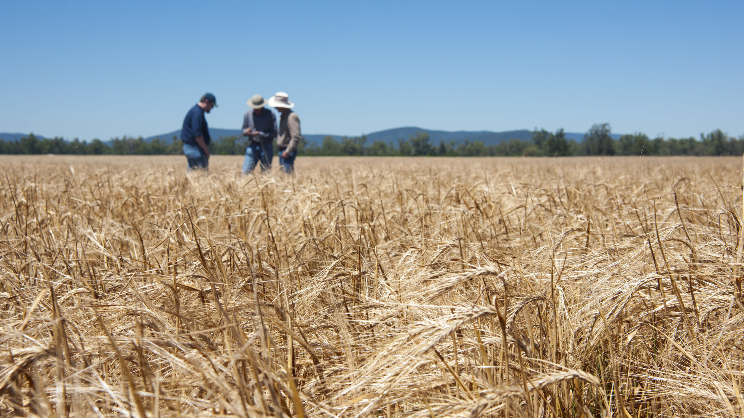
Microsoft and CSIRO are, for example, working together to explore how data can be integrated with analytics, modelling and deep domain knowledge to provide Australian farmers with accurate insights, assist in key farm management decisions, such as around sowing and harvesting, soil condition and how to understand weather and climate risk.

These sorts of data-driven farming techniques can boost agricultural productivity, improve sustainability, and reduce the use of often costly inputs such as fertiliser and pesticides – a win for the farmer, a win for the planet.
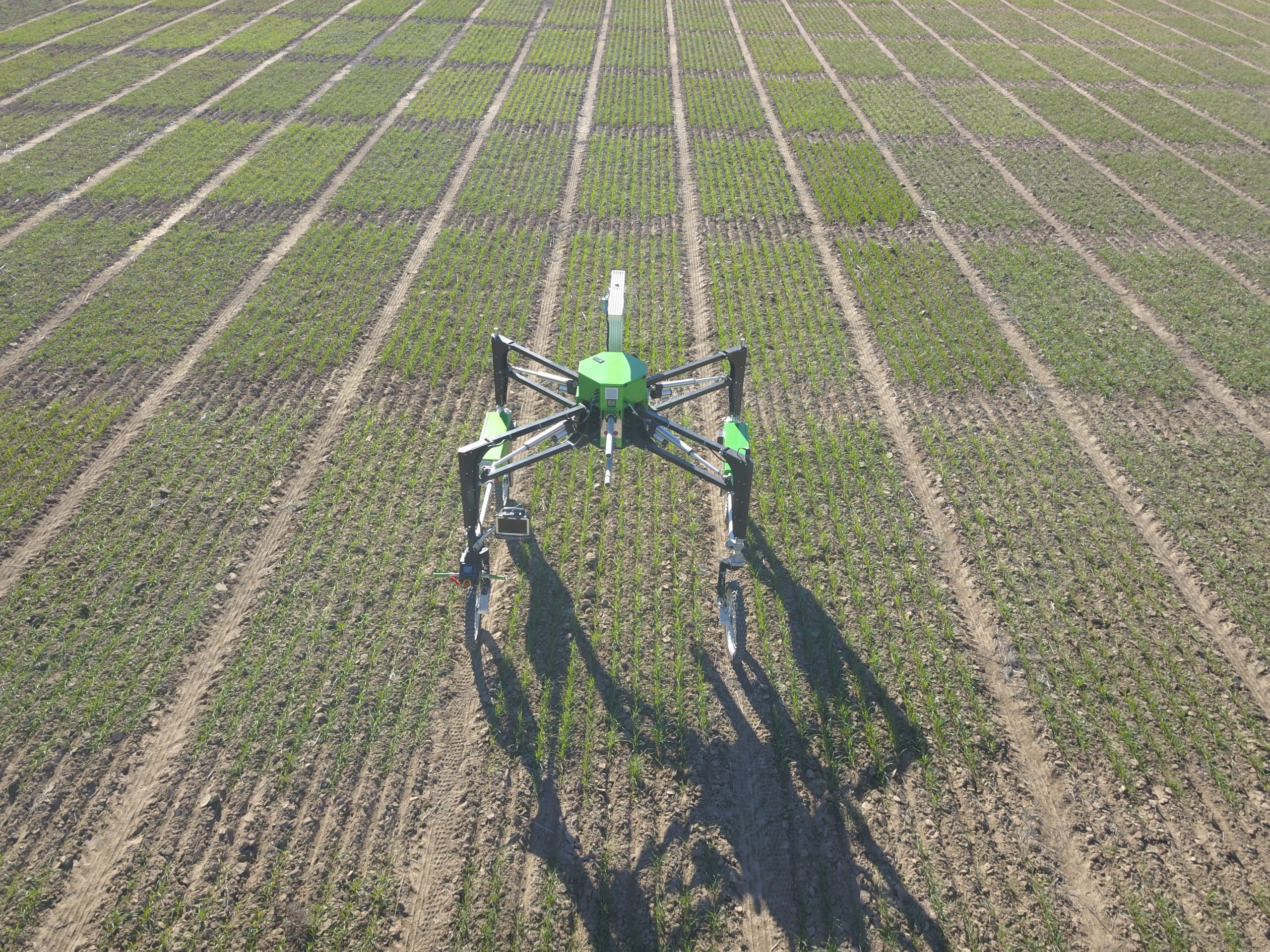
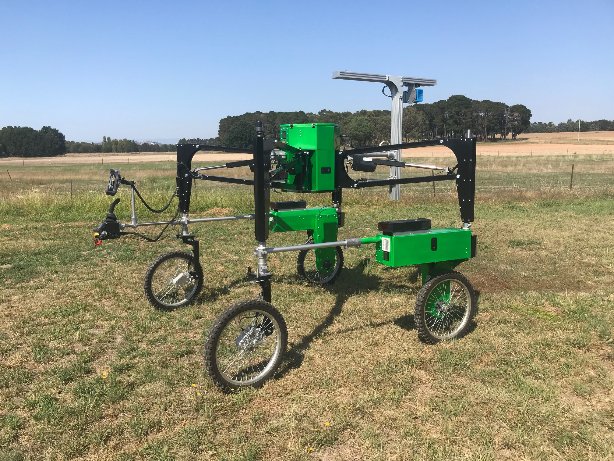
Solutions that use low-cost sensors, satellites, and vision and machine learning algorithms as well as innovative communications techniques are being developed at CSIRO’s new agricultural research station at Boorowa, NSW, a purpose-built 290 hectare facility that is helping develop Australian farms of the future by testing emerging technologies in crop science, agronomy and farming systems using CSIRO and Microsoft technologies.
Together the team is using Microsoft Azure FarmBeats to build several unique solutions to solve data-driven farming problems using low-cost sensors, satellites, and vision and machine learning algorithms to develop a connected digital agricultural ecosystem.
According to Dr Dave Henry, Principal Research Scientist at CSIRO, following the deployment of FarmBeats at Boorowa this January: “I’m seeing an ability to visualise what is going on across the farm in terms of soil moisture and temperature. I’ve seen images from satellites across the farm that tells me about health of vegetation. I see those being put together to interpolate or give us information on levels of soil moisture right across the farm. All of a sudden I’ve gone from thinking ‘there are sensors out on the farm somewhere’ to actually being able to visualise exactly what’s going on, and take actions accordingly. That’s really powerful.”
It’s these sorts of innovative endeavours that the partnership of CSIRO and Microsoft allows – an important step closer to a better world.
Agriculture and Farming

Fishing and Marine