Science, Indigenous knowledge and AI weave environmental magic
![]() Microsoft News Center
Microsoft News Center
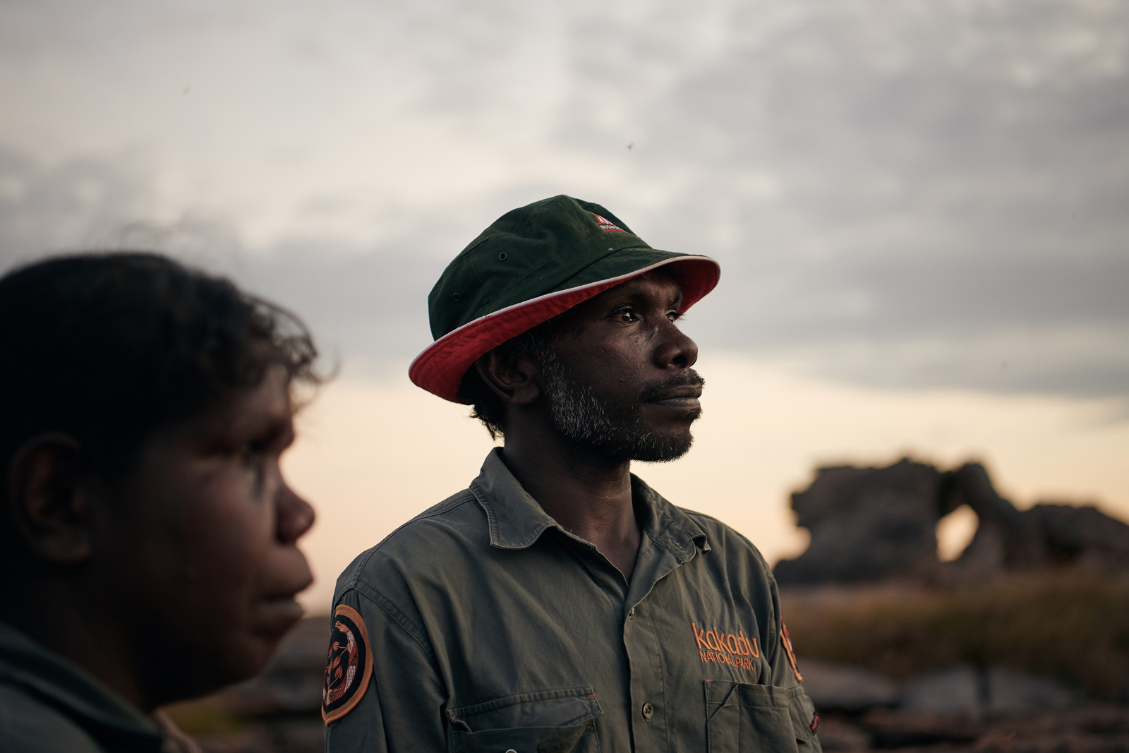
It’s dawn in Kakadu’s wetlands; the night’s inky silence gives way to bird song as the first rays reveal the emerald magic of the landscape.
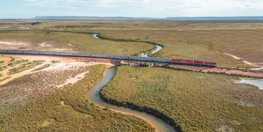
The dual World Heritage listed Kakadu National Park in Australia’s Northern Territory is one of the most beautiful places on Earth and a precious resource for its traditional owners who have hunted, fished and lived on the land for some 65,000 years.
It is also the site of a ground-breaking project, weaving together Indigenous knowledge, scientific research and artificial intelligence into a pioneering and adaptive co-management solution, creating a new framework for the way the world’s Indigenous communities can protect the environment and preserve biodiversity.
Biodiversity is facing numerous threats across the globe, causing species extinctions and ecosystem losses at alarming rates.
Analysis reveals that most of the planet’s vital ecosystems and threatened species are managed on lands owned by Indigenous people. Forty-five per cent of protected areas in Australia are managed by Indigenous populations.
The Healthy Country project underway in Kakadu brings together the Kakadu Board of Management, Bininj co-researchers and Indigenous rangers, CSIRO, Microsoft, Parks Australia, Northern Australia National Environment Science Program (NESP), University of Western Australia (UWA) and Charles Darwin University (CDU). Together they have a trial underway that is transforming the way the environment is being managed.
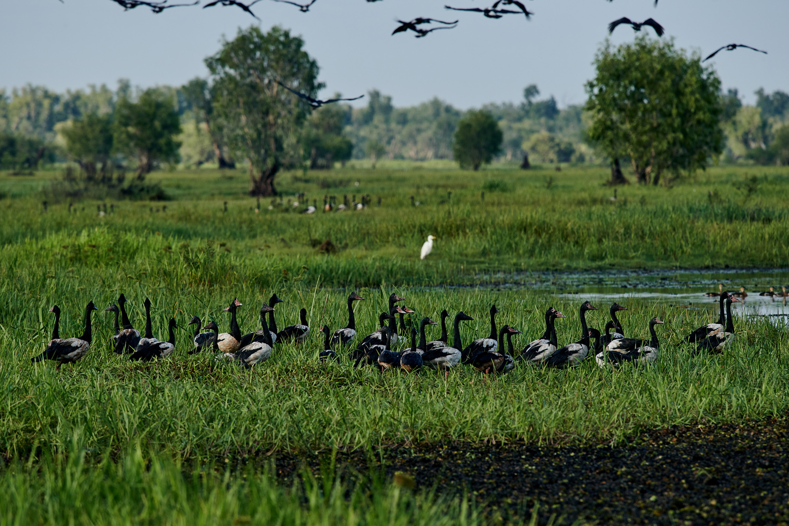
Kakadu’s wetlands are one of the last refuges for a number of protected Australian species, such as magpie geese which are considered a key indicator of ‘healthy country’ by traditional owners. But invasive species such as para grass, an introduced fodder crop which has become an aggressive and fast-growing weed in Kakadu, are displacing native plants and reducing the habitat for magpie geese, ducks and turtles.
The Healthy Country project has focussed on identifying the best ways to control, then eradicate para grass weed and bring back to country the magpie geese, ducks and turtles. And it’s working.
AI accelerates adaptive co-management
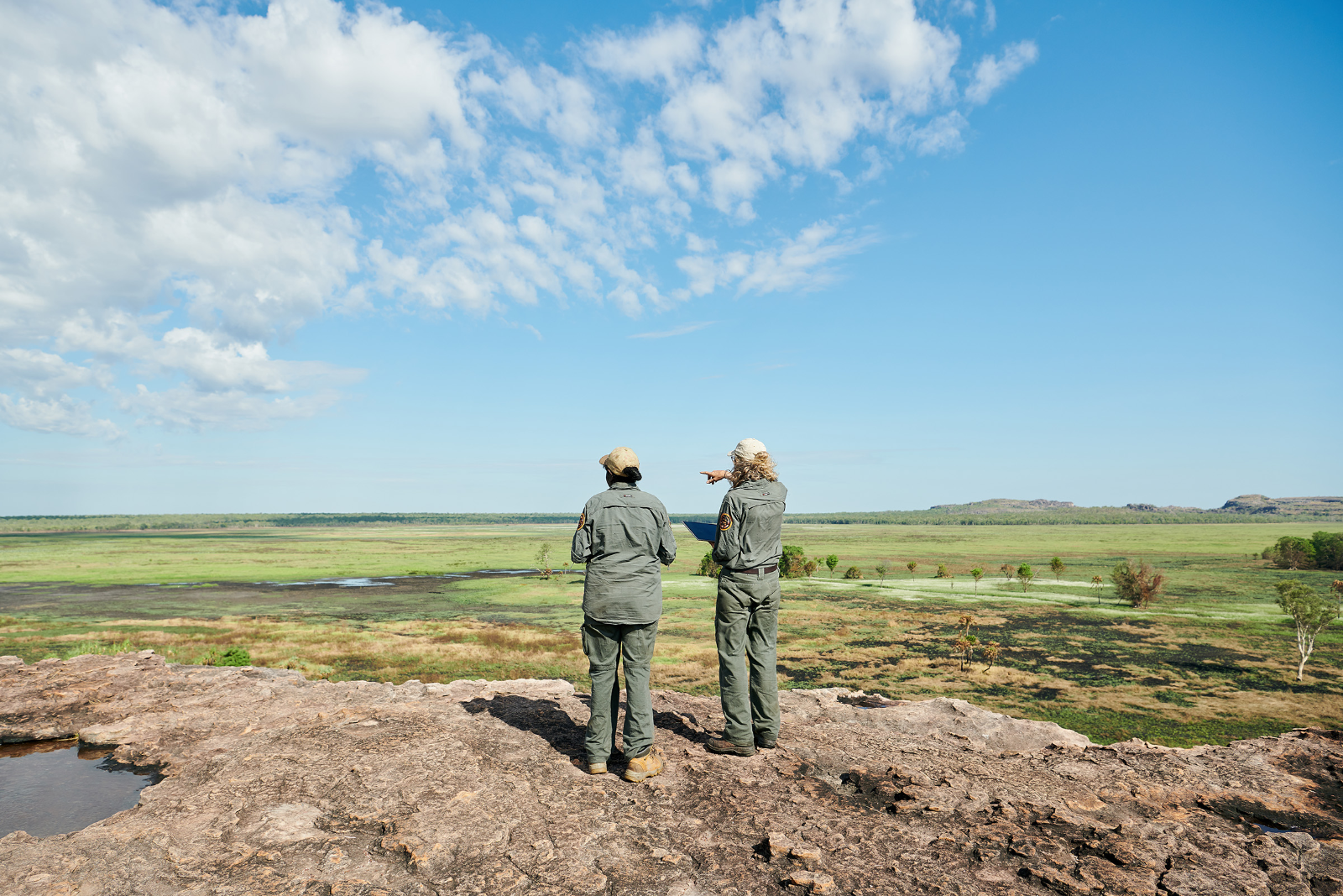
Northern Australia may be one of the most stunning places on earth – but it’s a challenging environment where cyclones and floods switch to the dry for half of the year. Park rangers and scientists whose job is to travel Kakadu to source environmental data are also fully aware that waterways are full of crocodiles, that buffalo and feral pigs roam the landscape, and that there are only limited resources to support them.
What data has been collected in the past has been somewhat limited, and getting it into the hands of the people able to act on it is a time-consuming process.
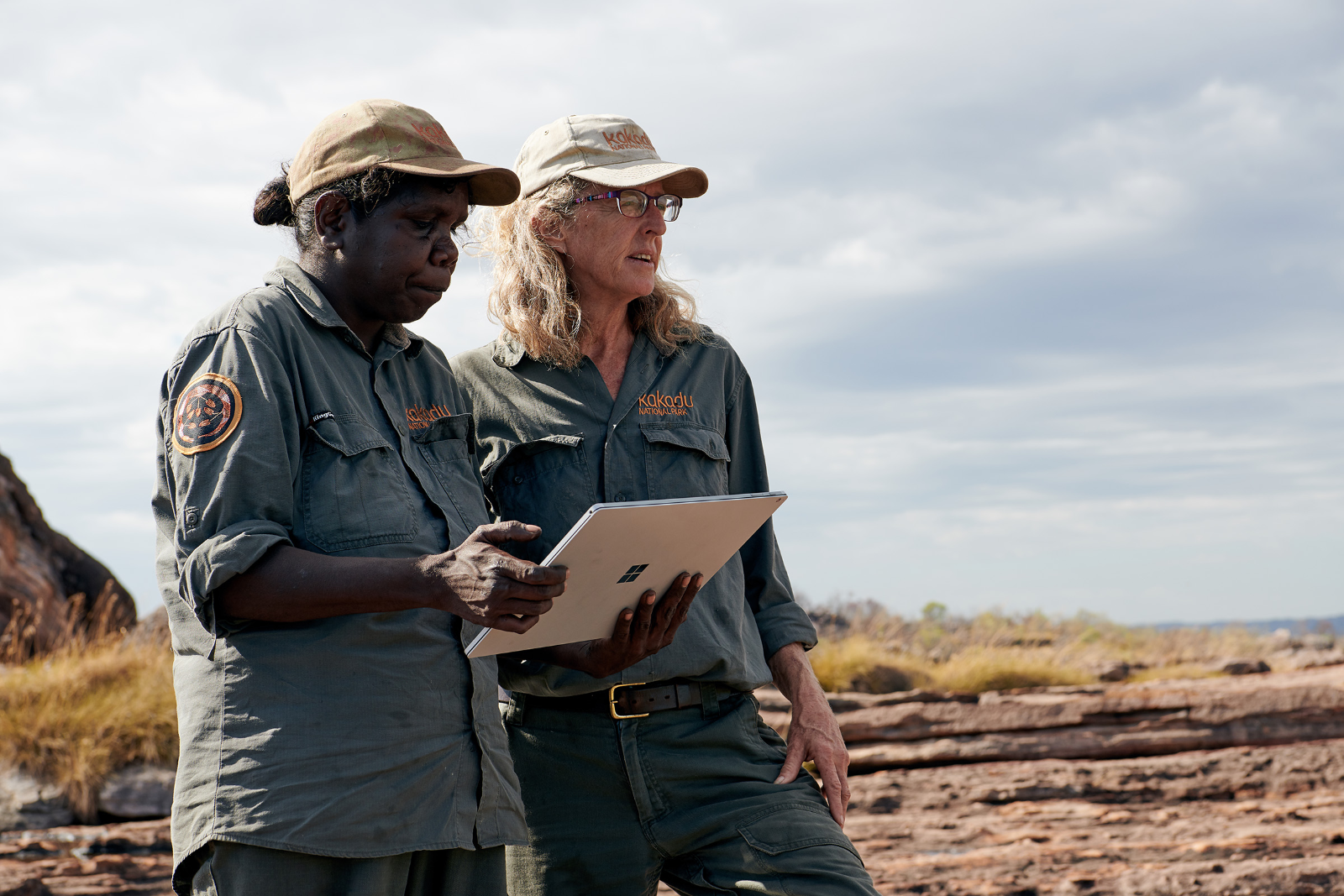
The Healthy Country project instead sources large quantities of data from drones, controlled by Traditional Owners. Artificial intelligence which combines Indigenous knowledge and scientific research then interprets that data, providing the insights in near real time to the rangers who manage the park.
Professor Michael Douglas, Leader, NESP Northern Australia Environmental Resources Hub and a Kakadu Board Member stresses that; “The need for good information to help us manage these landscapes is only increasing. The challenges from climate change and the threats from weeds and fire and feral animals are getting worse every year. The resources that we have to respond to those is getting less and less. So we have to work smarter.
“We have to do more with the limited resources we’ve got, and Microsoft AI can really make a huge difference there.”
But the project has been determined to ensure that this is truly responsible and ethical AI.
Douglas explains that before embarking on the Healthy Country project, the team spent 18 months identifying what Traditional Owners saw as high priorities for research in Kakadu National Park, focussing on Indigenous knowledge indicators for healthy country regarding weeds, fire, and feral animals and building on work already underway to manage Kakadu’s riparian zones, which include its rivers and floodplains.
According to Dr Justin Perry, CSIRO Research Scientist, Indigenous values are front and centre to the project. They steer all monitoring and management actions.
The data collected and resulting insights reveal to rangers and scientists how well their responses to environmental problems are working, allowing continuous improvement.
Douglas adds; “For me this project brings together 20 years of studying para grass, and the threat that it poses to floodplains, but for the first time we’re actually doing something about it. So, we’ve managed to completely remove para grass from a really important part of Kakadu’s floodplains,” he says.
And the magpie geese, ducks and turtles are returning
Douglas says; “Microsoft AI is going to revolutionise the way that we do research and manage Northern Australia’s environments. It means that we can collect more data than we’ve ever been able to do in the past. We can access locations, and at times of year, that we couldn’t do previously. But it also means that we can collect that data much more safely than we were able to do.”
Microsoft AI is also removing the need for people to physically review thousands of hours of video to count animals and identify para grass in its different states (burnt, wet, growing, dead). Instead, CustomVision AI, trained with machine learning, interprets the drone footage.
The results and analysis are then made available to rangers through a dashboard on a mobile device to support their on-the-ground decision making.
Dr Cathy Robinson, is Principal Research Scientist, CSIRO and stresses that it’s not just the speed at which information can be relayed that is critical, it’s also the ethical approach that has been adopted with Indigenous people leading the process, ensuring that their knowledge is handled in an appropriate way and producing outcomes that are supported by Indigenous people in an adaptive co-management setting.
“This is the essence of responsible AI…making sure that we benefit Indigenous people, and their knowledge, through every single step of the way.
“This is a very, very unique project. We’ve allowed AI to sit next to Indigenous knowledge, to inform adaptive approaches to caring for this land.
“AI has taken a view from the sky, through drones. We’ve woven those together and thought about that platform design, so that it’s usable for Indigenous people. In every part of that process, we’ve had to make sure that Indigenous knowledge is protected appropriately. That Indigenous knowledge is used appropriately to guide management decisions, and that we weave science, including AI, so that we can do that together, to deliver healthy country outcomes.”
Working with Bininj people on the Indigenous led research process the project melds AI with Indigenous knowledge to guide adaptive co-management. Says Robinson; “So what does adaptive co-management mean? It means we’re building the evidence base, to make better decisions. We’ve got to make those decisions together, and we’ve got to build a different evidence base to help that.”
Robinson is also convinced of the global potential of the work underway at Kakadu. “Across the globe, Indigenous people are handling some pretty challenging questions. Their planet is under pressure, and much of that planet is owned by Indigenous people, particularly areas that have got high biodiversity assets. Threatened species, important ecosystems, fabulous cultural heritage spots,” all of which need effective and sensitive management.
With that in mind the adaptive co-management framework is opensource and being made available on GitHub allowing the solution to be used internationally.
Responsible AI, ethical data governance
The AI which interprets the drone-collected data has been built with the advice and guidance of the Traditional Owners in regard to what is important to them from a land management perspective.
That could be information about the presence or absence of animals. It could be information about the condition of different types of grasses or trees. That then feeds into the AI models developed to interpret the data.
The results and analysis are delivered to rangers via a Power BI dashboard that was designed in partnership with the Traditional Owners based on their cultural values and the season. Rangers can use the dashboard to support their decision making regardless of where they are based.
The solution has been constructed with several layers of privacy as some of the sites where the drones collect data are sites sacred to the Traditional Owners, and as such, imagery and data from those sites needs to be properly protected.
The platform features three rings of data management and data governance. The innermost data ring is restricted to Traditional Owners, rangers and Indigenous elders who identify which data can be made available to the second ring.
The data in the second ring can be accessed by researchers and collaboration partners. The outermost ring is data that can be made available for more public consumption.
Microsoft Australia machine learning engineer Steve van Bodegraven says the Healthy Country platform is an exemplar of responsible and ethical AI.
“Everything is led by Indigenous people with Indigenous knowledge and their permission. It’s not the first time that technology has needed to address privacy and security issues. We can go back to publicly identifiable information and your credit card details and your address. From a technology perspective it’s very similar to that.”
In this project “It’s working out how we apply those same quality checks and controls to Indigenous knowledge.”
According to van Bodegraven the development of an open source co-management framework using responsible AI and ethical data management has enormous implications for the management of other environments around the world. While the AI models used to interpret the data would need to be modified for other environments using machine learning to account for different flora, fauna and landscapes, the underlying framework would be globally applicable.
The magpie geese return
In Kakadu a drone is flown over the landscape by an Indigenous ranger following a grid pattern. Data from the drone is downloaded, stored in a file and synchronised to Azure. Using Azure-based Jupyter notebooks data scientists construct models that interpret the data taking account of Indigenous knowledge of the environment and its different seasons.
The more data collected the greater the opportunity to refine and improve the AI algorithms.
In the future additional sensors will be deployed (multiband/LiDAR) to collect more data and provide additional options to classify the landscape and deliver even more insights to rangers.
CustomVisionAI is used to review the drone-collected video and identify plants and animals. CustomVisionAI has two models operational with a further 10 to follow; the associated Machine Learning Service has one model and another will be added.
The insights from the analysis are then made available through Power BI in a self-service dashboard.
Van Bodegraven explains that the self-service dashboard – which is being continually refined – combined with the growing Azure-based data collection allows rangers to focus in on a single water hole and explore it centimetre by centimetre. They can then scan out over a wider area, and monitor the environment month by month, metre by metre.
“We can go back to December last year see how it looked like. Fast forward to March this year. Fast forward to September. Fast forward to December again and see how the land has changed over time. If the animals have changed over time,” he says.
“Then introduce the information from the activities that we’ve applied to the land. So spraying and back burning are two common examples. When those actions have been applied to the land how has the land changed as a response? Then collecting that data so we get a cyclical outcome. We’ve applied this action to the land. This is how it responded. How is that happening across seasons? How’s that affecting the longitudinal activities of the land?”
As it turns out, it’s having a very positive effect says CSIRO’s Justin Perry.
“We’re controlling para grass, which is an invasive weed on wetlands. The aim is to bring back important cultural and social environmental values. That includes, in this case, looking at how magpie geese come back into these systems after we’ve done the management intervention.
“Microsoft AI’s allowed us to accelerate the impact of this project.”
After a year’s careful management, including spraying the para grass weed, the native plants have returned. So have the magpie geese, ducks and turtles.
Says Perry; “We’ve seen almost a thousand more magpie geese come back to this wetland. Magpie geese have been identified as one of the key values for Bininj and are a really important part of the ecology of northern Australia. So, the more areas that we can start to bring back to their natural state and allow these wonderful birds to come back to these areas the better it’ll be.”