
Our time is short, and resources to help avoid the worst impacts of climate change are spread thin – but we must never give up.
Microsoft’s AI for Earth initiative places cloud and AI tools in the hands of those working to tackle global environmental challenges, in areas including climate, agriculture, water and conservation.
Partnering with National Geographic Society (NGS) on the AI for Earth Innovation Grant Program, Microsoft is combining its AI expertise with NGS’ 130 years of experience in supporting changemakers to explore the world. This partnership builds on Microsoft’s five-year $50 million AI for Earth program commitment, which has awarded more than 180 grants and supported eight organizations in larger projects since its inception a year ago.
Today, both Microsoft and NGS have announced the latest 11 grant winners out of a competitive pool of more than 200. They represent the most promising ideas for AI applications to address global concerns around water, biodiversity, agriculture and climate change. Given the incredible response, the program has also been expanded from $1 million to $1.28 million.
The power of human ingenuity and exploration, amplified by AI, has incredible potential to create a better future for us all. AI can play a critical role in speeding up and scaling out data and insights that lead to new solutions, but there’s been a gap in adoption of AI in these fields. Budget or knowledge should never be a blocker to creating a better future, which is where AI for Earth comes in.
Below is a summary of the newly announced European grantees and their projects. Please visit the Microsoft On the Issues blog post for more information, and the full list of all the worldwide grantees.
Improving irrigation efficiency in Uganda
– Torsten Bondo, Denmark
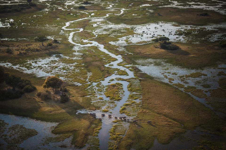
To get more yield with fewer resources, precision is key – especially with a precious resource like water. One way to know how much water crops really need is to measure how much water evaporates from the soil and plant surfaces. This is known as the evapotranspiration (or ET) rate, which helps farmers improve their watering efficiency.
Torsten Bondo and Radoslaw Guzinski are exploring how to generate field-level ET measurements using machine learning and satellite imagery. They’re developing an open-source algorithm that can merge data from optical and thermal satellites as well as meteorological data to determine the right amount of water for effective irrigation.
The system will be tested on a large national irrigation scheme in Uganda, where water is becoming scarce due to a growing population and climate change, and the team predicts that this method could reduce water use by up to 30 percent for the same yield within the district. Ultimately, their goal is to achieve better irrigation practices in other drought-prone countries around the world, helping save water and providing food for generations to come.
Monitoring insect sounds in tropical rainforests
– Holger Klinck, Germany
While the benefits of rainforests are well known, we still lack a detailed understanding of the species and ecosystems contained within them, due to their high canopies and dense vegetation which make it hard to observe wildlife.
Holger Klinck and Laurel Symes of Cornell University’s Bioacoustics Research Program are utilising AI-powered acoustic monitoring of insects as a way of better understanding the dynamics of rainforest habitats.
Insects in particular are a good indicator of the health of their local environment, as they rarely travel from where they’re born. They also normally produce a single mating call that varies little within a species, making their identification and classification easier.
Klinck’s team is focusing first on neotropical rainforest katydids, a diverse species that occupies a central position in tropical food webs. How the wide variety of katydids interacts with the rest of the forest species, both plants and animals, can provide lots of information about the overall ecosystem. Klinck aims to scale beyond insects to other species, including birds, monkeys, and other vocal animals, to help advance conservation of tropical rainforests.
Gaining a better understanding of Earth’s melting glaciers
– Joseph Cook, UK
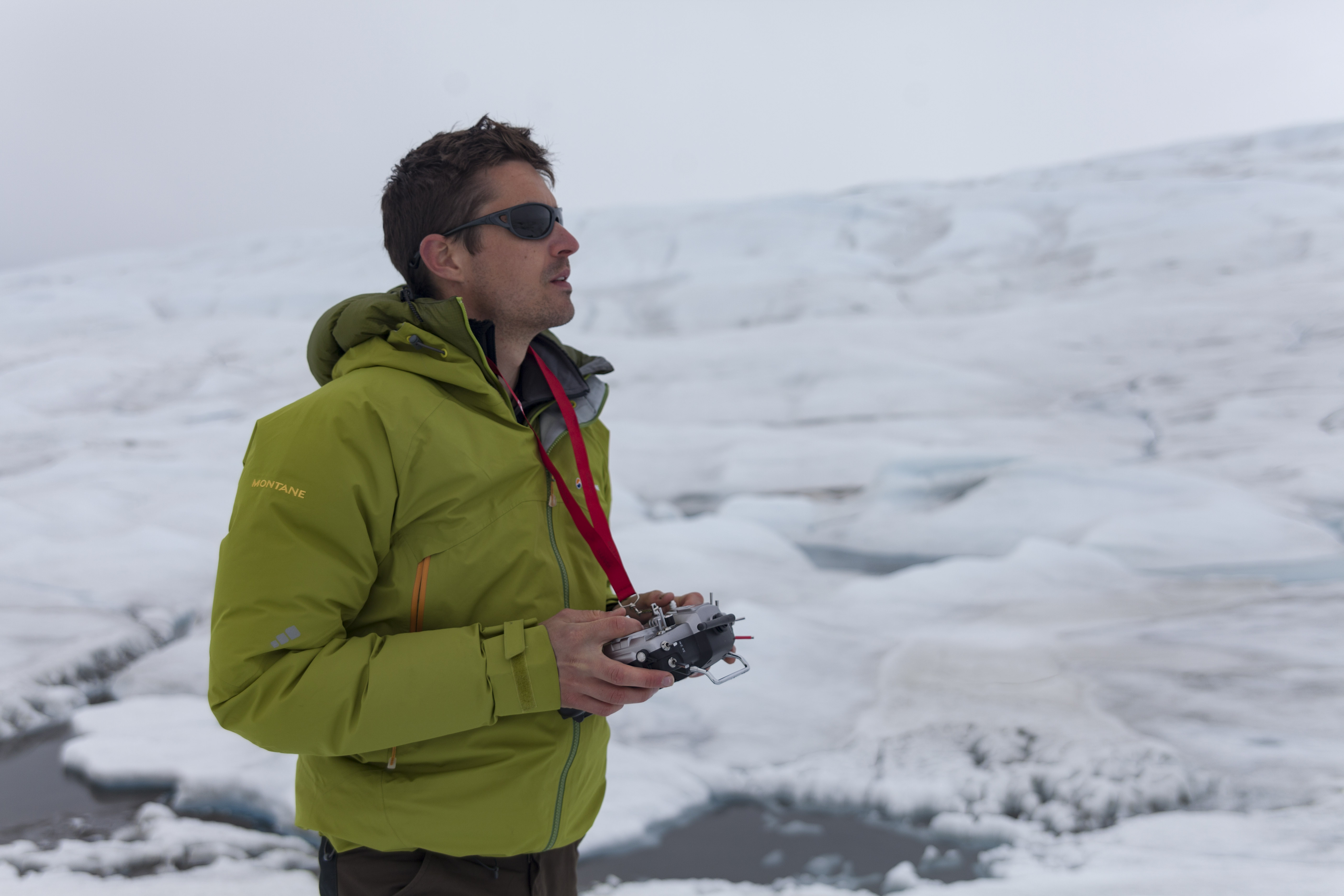
Melting glaciers provide some of the most substantial evidence of the Earth’s warming temperatures, but collecting data to measure these changes can be tricky, as the UK’s Joseph Cook is all-too-familiar with.
Cook has conducted more than 12 Arctic field expeditions in the last decade, mostly in field camps on the Greenland Ice Sheet, and has contributed findings and research insights in scientific journals, documentaries, and conferences around the globe.
These experiences led Cook to utilise machine learning, using it to process optical data from drones and satellites to explore the changing cryosphere. The key is capturing the complexity of ice surface evolution, from pristine snow to dust-covered, algae-covered, and waterlogged ice.
By training the algorithms to recognize how different surfaces – such as fresh to algae-covered snow and ice – reflect certain wavelengths of light, the study of vast areas becomes feasible. After testing the algorithms on imagery from custom-built drones, Cook’s team can scale the process up to entire glaciers, by applying their findings to satellite remote sensing data.

