How AI for Earth can be a force multiplier for sustainability solutions
The 21st century is the age of data and artificial intelligence, two powerful tools with the potential to solve some of the world’s most pressing problems. Yet many researchers and leaders are still trying to take on today’s challenges using tools from the past — especially when it comes to protecting the environment.
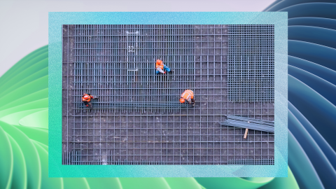
Take, for instance, the iconic Chesapeake Bay: Its watershed stretches from Pennsylvania south to Virginia in the United States, spanning more than 64,000 square miles and supporting more than 3,600 species of plants and animals. Despite its importance, its health over decades has been marred by sewage overflows and runoff of animal waste and chemicals. The future of the watershed, home to 17 million people, depends upon smart conservation that is informed by data about where growth is least harmful and where interventions can be most helpful.
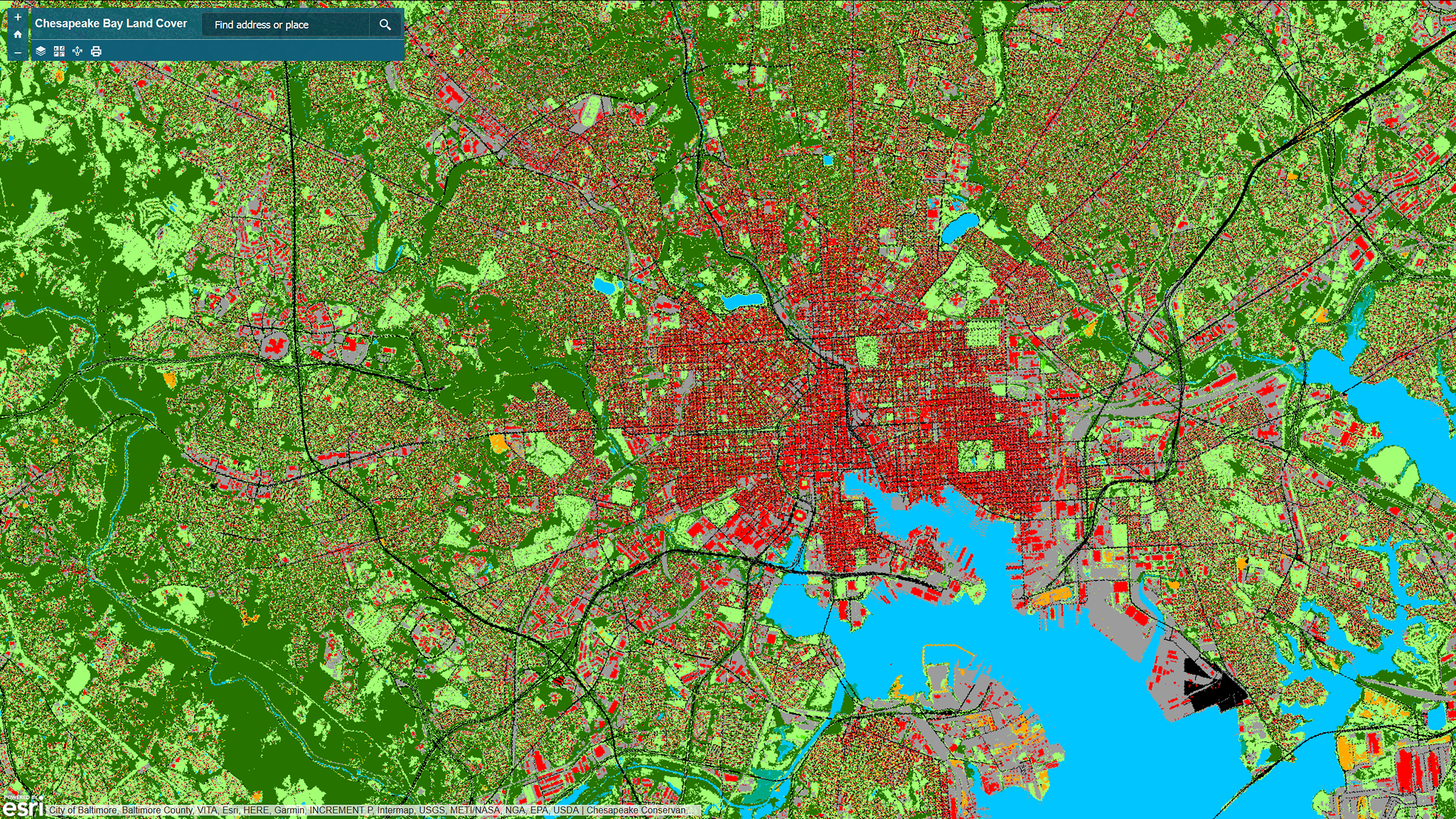
That requires a detailed, precise, current map of the region. Until recently, that simply didn’t exist because collecting so much data and converting it into usable land-cover maps was an onerous, expensive and tediously slow process. But now the Chesapeake Conservancy, a small nonprofit dedicated to protecting and restoring the lands and waters of the Chesapeake Bay, has used the 21st century power of cloud computing to create a new, up-to-date map.
The precision mapping is a kind of “MRI on the landscape,” says Joel Dunn, Chesapeake Conservancy president and CEO. It allows for a kind of precision conservation that was previously impossible — and it’s a strategy that could be used to help protect other imperiled waterways around the globe, if individuals and organizations can access the technology that made this possible and use it to its fullest potential.
Right now, access to today’s AI technologies comes at a price and requires computational expertise that put it out of reach of many, especially researchers and small NGOs working on these environmental challenges. Through AI for Earth, Microsoft hopes to change that reality. It is investing $50 million over five years to put AI in the hands of individuals and organizations around the world who are working to protect the planet.
AI for Earth is focused on applying AI to four environmental risk areas — climate change, agriculture, biodiversity and water — and is being overseen by Microsoft Chief Environmental Scientist Lucas Joppa.
Having a chief environmental scientist is a first for Microsoft. Joppa, who spent much of his early years exploring the forests surrounding his rural Wisconsin hometown, has a Ph.D. in conservation biology and was a Peace Corps volunteer in Malawi. At Microsoft Research, he was a longtime lead in computational ecology before being named to the new position last July.
AI for Earth was first launched in July 2017, at a more modest funding level of $2 million. In the first several months of the program, Microsoft awarded over 35 grants in more than 10 countries for access to Microsoft Azure and AI technology, for applications ranging from species abundance modeling to live poacher detection in drone imagery. It also hosted its first AI for Earth educational summit in the fall, bringing together 30 participants from 17 organizations.
The interest and innovation drove Microsoft to make a deeper commitment in December 2017. Explaining it as “more resources coupled with a long-term commitment,” Microsoft will do this in three ways. First, Microsoft will expand seed grants around the world to create and test new AI applications. The company will also provide universities, NGOs and others with advanced training to put AI to its best use, Joppa says.
“If you’re an environmental organization, or an individual environmental researcher or scientist, and you have a good idea of how you want to apply Microsoft’s tools to environmental science — we want to help you do that,” Joppa says.
Next, as these projects and Microsoft’s work in this area mature, Microsoft will identify the projects that show the most promise and make larger investments to help bring them to scale, Joppa says.
Microsoft will do this not only by providing greater resources for these projects, but also by partnering closely and working in depth with a new multi-disciplinary team at Microsoft that will bring together AI and sustainability subject matter experts.

The program now also has commercial aims. As announced in December, Microsoft will help a select number of grantees to commercialize these services, so they can have a global impact as quickly and broadly as possible, Joppa says.
“These will be in addition to our existing efforts enabling real-time precision conservation and improving land cover mapping, precision agriculture to increase yield with fewer resources with FarmBeats and more efficient, effective biodiversity tracking and protection approaches through Project Premonition,” he says.
FarmBeats is using AI to focus on how to provide enough food to feed an expected worldwide population of 10 billion by the year 2050, and the issue of not having enough arable land for growing that food.
Now being tested in several pilot sites, FarmBeats uses inexpensive sensors, drones, low-cost broadband connectivity using TV white spaces, and vision and machine learning algorithms to help maximize the use of dwindling agricultural land by giving farmers precise information about soil temperatures and soil moisture so they know exactly when the best times are for planting.
As the climate changes, this data becomes more important. Droughts and shifts in planting seasons are new and not predictable. FarmBeats provides an easier way for farmers to improve their agricultural yields, lower their overall costs and reduce the environmental impact of farming.
FarmBeats is “really about trying to bring precision agriculture in the technology-meets-agriculture space to a much broader array of people,” Joppa says.
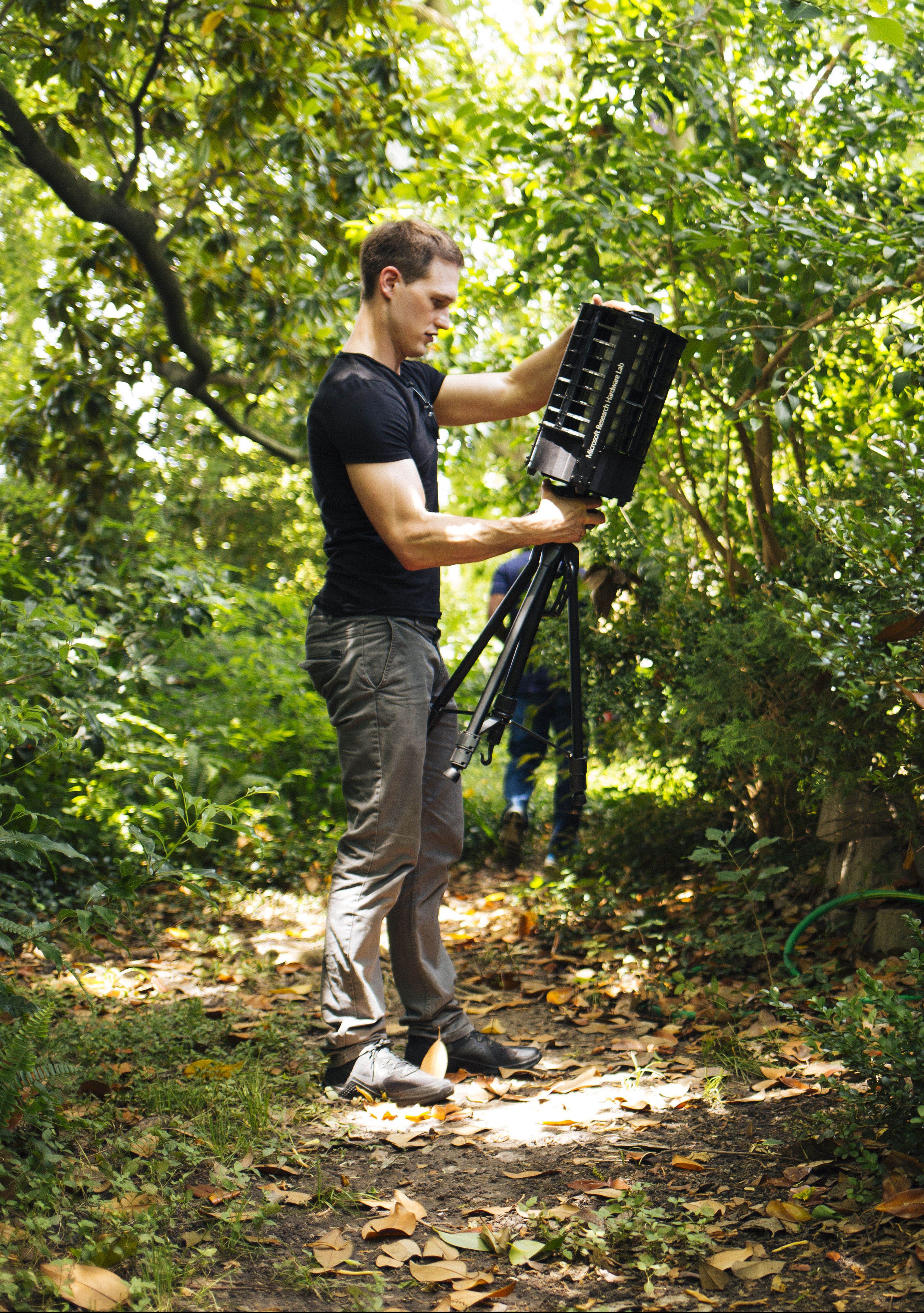
Project Premonition began as a project using AI to detect emerging infectious diseases, such as Zika or Ebola, in advance. As an AI for Earth lighthouse project, researchers are working to apply the same techniques to monitor the health of animals – not just humans.
“There’s a really fantastic intersection of interests here,” says Joppa. “From an AI for Earth perspective, we care because if you want to have premonition about diseases, and if you want to be able to build early-warning systems, then that means you have to be able to be sampling and monitoring the environments where those diseases are hiding before they break out in human populations. That broader environmental monitoring effort is perfectly aligned with our mission.”
Monitoring and gathering samples from mosquitos in traditional ways is not only tedious, but time-consuming. Project Premonition uses drones that autonomously locate mosquito hotspots, robotic traps to identify and collect specimens, and cloud-scale genomics and machine learning algorithms to search for pathogens and the wildlife species that host them.
For AI for Earth’s goal of scaling innovation, Microsoft will identify and pursue opportunities to incorporate new AI advances into platform-level services so that others can use them for their own sustainability initiatives. Some of this will involve platform services that will be offered by others. In other instances, these may be incorporated into Microsoft’s own platform services.
Rob Bernard, chief environmental strategist for Microsoft, says AI for Earth melds perfectly with Microsoft’s larger missions of sustainability and innovation.
“When we think about our role as a company, and an organization at the scale that we operate, we have both an obligation and an opportunity to have a significant, positive impact on these challenges,” he says.
Microsoft is “very committed to sustainability and the ways our technologies can have a very significant impact,” Bernard says. “I think our employees, customers and partners will be excited as we continue to roll out more programs like AI for Earth and expand our investments, because while there are a lot of challenges, there’s massive opportunity.”
This partnership model is paying off in the Chesapeake Bay. Working with Microsoft allows the Chesapeake Conservancy to build on its innovative map project and begin to scale. The conservancy is now working with Microsoft and Esri, a mapping and geographic information system leader, to apply a deep-learning approach to create an algorithm for updating the existing precision data, and to make it available to other partners across the U.S. to create similarly detailed maps. The project also demonstrates the power of AI to help smaller nonprofits such as the conservancy, which has a staff of just 20 people.
“We don’t have artificial intelligence computer scientists on our team,” says Jeffrey Allenby, the conservancy’s director of conservation technology. “And to have access to the amazing staff at Microsoft and at Esri, to be able to enable our dreams and put them into action — it’s just one of those too-good-to-be-true moments where you have to pinch yourself.”
Joppa believes this is just the beginning. “The AI for Earth program represents a massive opportunity to take advantage of Microsoft’s long-standing investments in both AI and sustainability, and empower partners of all types, all around the world, to build solutions at scale.”
————————————————————————–
Lead image: Precision mapping of the Chesapeake Bay will help give public and private organizations a better idea of what is located in every square meter of land around the bay to help with conservation efforts.