Diving Deeper: How AI is helping to map the way Western Australia protects its sea floor
![]() Microsoft News Center
Microsoft News Center
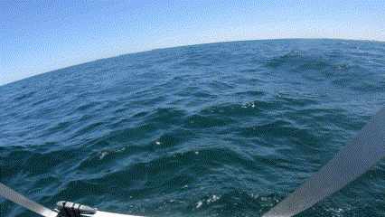
Beneath the shimmering surface of Western Australia’s aquatic ecosystems lies a world teeming with life and activity – benthic habitats. These submerged communities of seagrass, macroalgae and other organisms are not only vital to the survival of a diverse range of aquatic animals, but also play a crucial role in the overall health of our planet’s oceans and freshwater systems. From nutrient cycling to sediment stabilisation and water filtration, benthic habitats are a true cornerstone of earth’s natural balance.
“Benthic habitats provide primary life support to a lot of the organisms that reside around the sea floor,” says Dr Renae Hovey, a researcher and Senior Lecturer in marine science at The University of Western Australia.
“For example, fish might use these habitats for shelter and protection from predators, or they might hunt for their food in amongst those organisms that are attached to the sea floor.”
However, Dr Hovey notes that benthic habitats face several threats to their own survival.
“There’s obviously climate change, which causes species to shift their distributions. So, we might see more tropical benthic species where there used to be temperate benthic species,” she explains. “This shift can alter the dynamics of the [marine] ecosystem and the types of animals that live there.”
Dr Hovey says there are other threats that cause a more rapid response in the ecosystem. These include the physical removal of benthic habitats through dredging or coastal developments, or a degrading of the water quality.
“Off Western Australia’s coastline, we have what we refer to as low-nutrient water, so the water clarity is really good,” she says. “But by adding nutrients, which usually come from land-based sources, we change the organisms in the water column.
That reduces the amount of light reaching the sea floor, and that has a huge negative impact on things like seagrasses and macroalgae, which need a lot of light to survive.
Filling knowledge gaps with benthic habitat maps
To better understand benthic habitats and how they’re affected by human activities, researchers like Dr Hovey create detailed maps of the sea floor. These maps provide valuable insights for decisions about coastal developments such as the Western Australian Government’s Westport program. The program features a proposed new container port with integrated road and rail transport networks, to be built in Kwinana.
Benthic habitat mapping is one of 31 projects under a $13.5 million research program being undertaken by the Western Australian Marine Science Institute (WAMSI) in partnership with the State Government’s Westport Program.
Led by Dr Hovey, the three-year mapping project aims to improve stakeholders’ understanding of temperate benthic communities and processes – specifically seagrass, macroalgae and macroinvertebrates – in three areas relevant to the Westport program: Cockburn Sound, Owen Anchorage and Gage Roads. It will fill knowledge gaps relating to these habitats, which will improve environmental impact assessments and natural resource management within the proposed development regions.
“There are lots of legacy issues in Cockburn Sound around poor human practices,” says Dr Luke Twomey, CEO of WAMSI. “Lots of pollution back in the 60s, 70s and 80s led to the loss of about 80 per cent of the seagrass, and it had a major impact on the fisheries and the ecology of that particular system.
We want to gain a better understanding of how seagrass survives in the system and what the drivers are, like the types of nutrients they need and their annual cycles. And we want to use this knowledge to encourage seagrass to continue in this system and flourish.
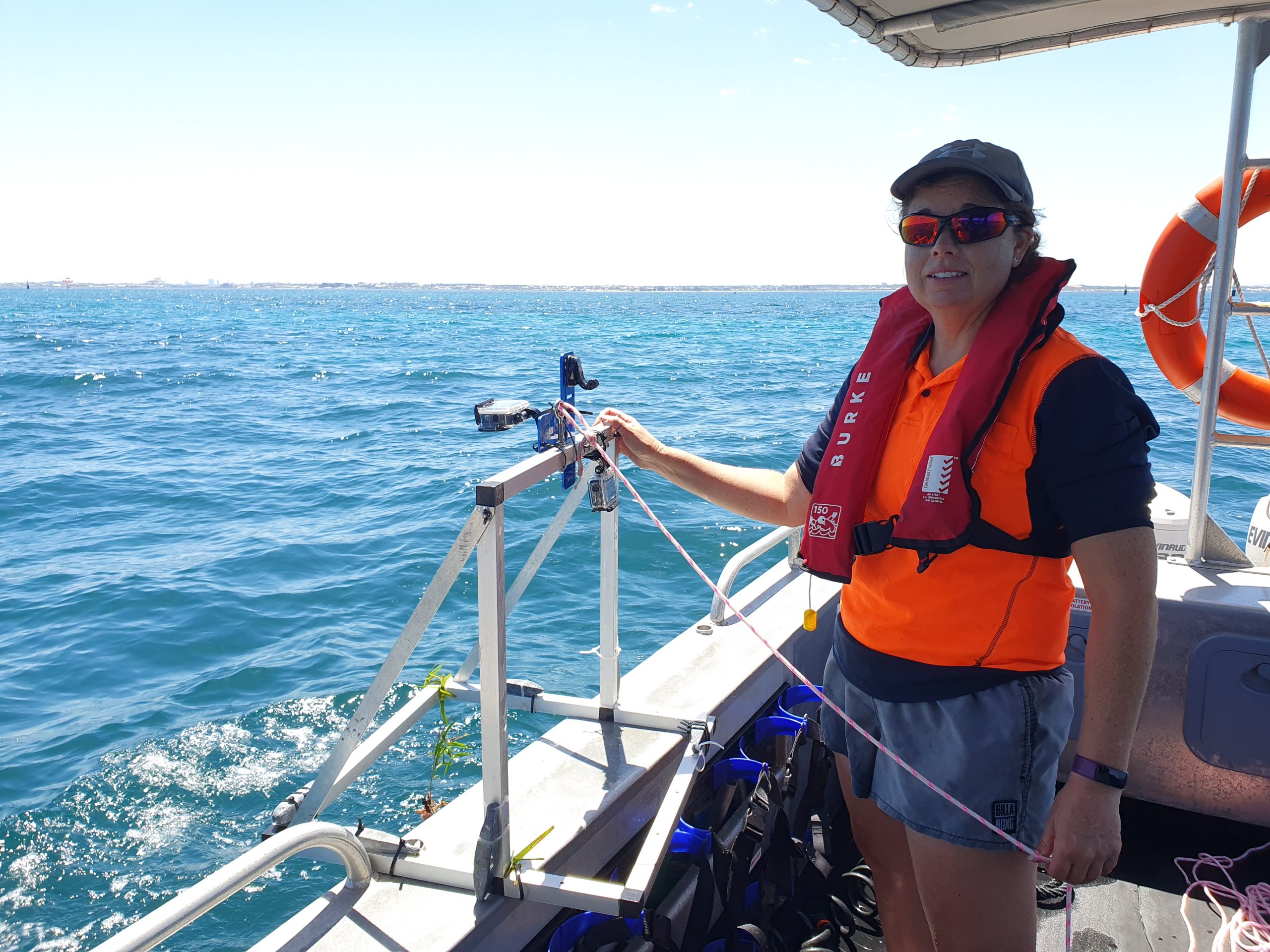
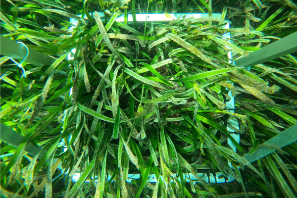
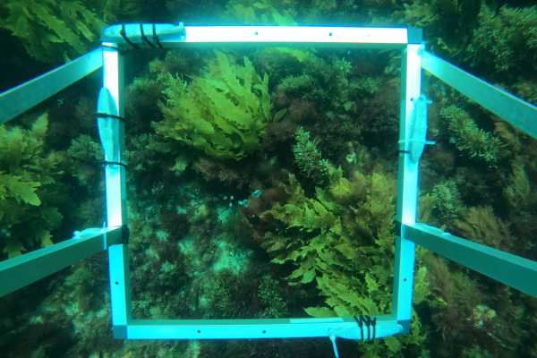
The major challenge for Dr Hovey and her team of researchers was that traditional benthic habitat mapping methods are labour-intensive, time-consuming, costly and sometimes dangerous.
“Traditionally, a lot of underwater data is collected by divers, but it’s becoming harder and harder to actually get in the water and dive because it’s so expensive and time-consuming,” she explains. “Plus, a lot of the things we need to be looking at are beyond 10 metres, so it becomes quite difficult to do a number of dives per day beyond that depth.”
Researchers also tend to spend hours each day manually classifying thousands of images, which leaves room for human error.
New mapping methods to unlock big time and cost savings
To increase the speed and accuracy of benthic habitat mapping, Dr Hovey and her team are trialling innovative remote sensing technologies that leverage Microsoft’s cloud, space and AI capabilities.
These include satellites that regularly capture high-resolution imagery of the sea floor in Cockburn Sound, Owen Anchorage and Gage Roads. This data will then be fed into the Microsoft Azure cloud via Azure Orbital Ground Station for researchers to analyse.
Dr Hovey says satellites are particularly effective for mapping shallow coastal habitats that are close to shore.
“We can take a satellite image and then designate the different components of that image, which is usually based on pixel colour,” she explains. “But to really be sure of what those different colours represent, we have to get into the field.
“If it’s shallow enough, we’ll usually deploy divers from a boat, and if it’s a bit deeper, we’ll deploy underwater cameras. This allows us to take a closer look at what’s on the sea floor, and we use that information to ‘ground truth’ the satellite imagery.”
WAMSI’s research team is also using autonomous underwater vehicles fitted with cameras that take photos and videos, which will be uploaded to the cloud. These vehicles are a game changer for mapping benthic habitats, according to Dr Hovey.
“They allow us to explore those deeper coastal habitats and take a look at what’s there on the continental shelf,” she says. “We can pre-program these vehicles to go and collect the imagery we need, come back to the surface, and then we can pick up the vehicle and deploy it at our next site.”
Rather than requiring experts to annotate the hundreds of thousands of photos and videos collected by autonomous underwater vehicles, WAMSI’s research team is testing Microsoft’s Azure AI capabilities to process and classify this imagery.
“We’ve had some pretty good success with training an algorithm to detect and identify different seagrass species in Cockburn Sound, Owen Anchorage and Gage Roads,” says Dr Hovey.
“It gives us a really quick indication of whether these benthic habitats are changing, and whether it’s a positive or negative change.
It’s three orders of magnitude quicker to process the data using AI than it is to sit down and do it manually, which is huge in terms of saving time, but also saving on costs.
In addition to the time- and cost-saving benefits, Dr Twomey says AI will improve the quality of data that the researchers use to create benthic habitat maps.
“When you have a human in there, you have a very high risk of making mistakes or having differences between analysts,” he explains. “But if you have the consistency of AI, you’re able to bring the error bars of those maps down and have much higher-quality data coming through.
“From an industry perspective, it also sets up a common data set, rather than having many disparate ones. So, it makes the job of the regulator much easier because industries are all working off the same regional habitat map. And it will result in better and faster decision-making.”