

AI may hold a key to the preservation of the Amazon rainforest
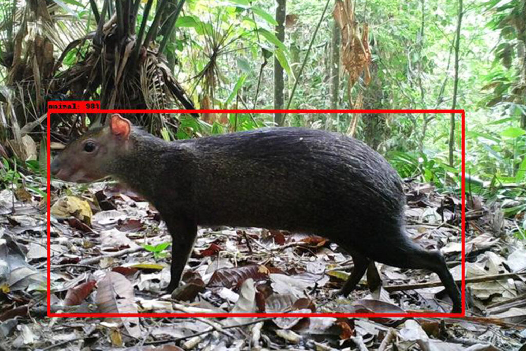
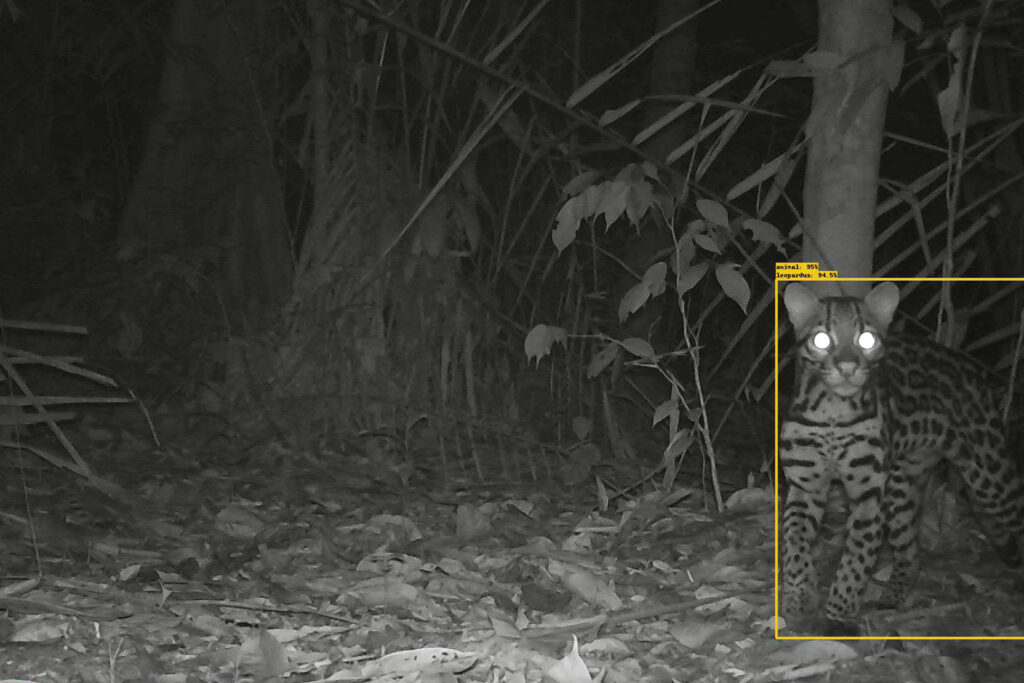
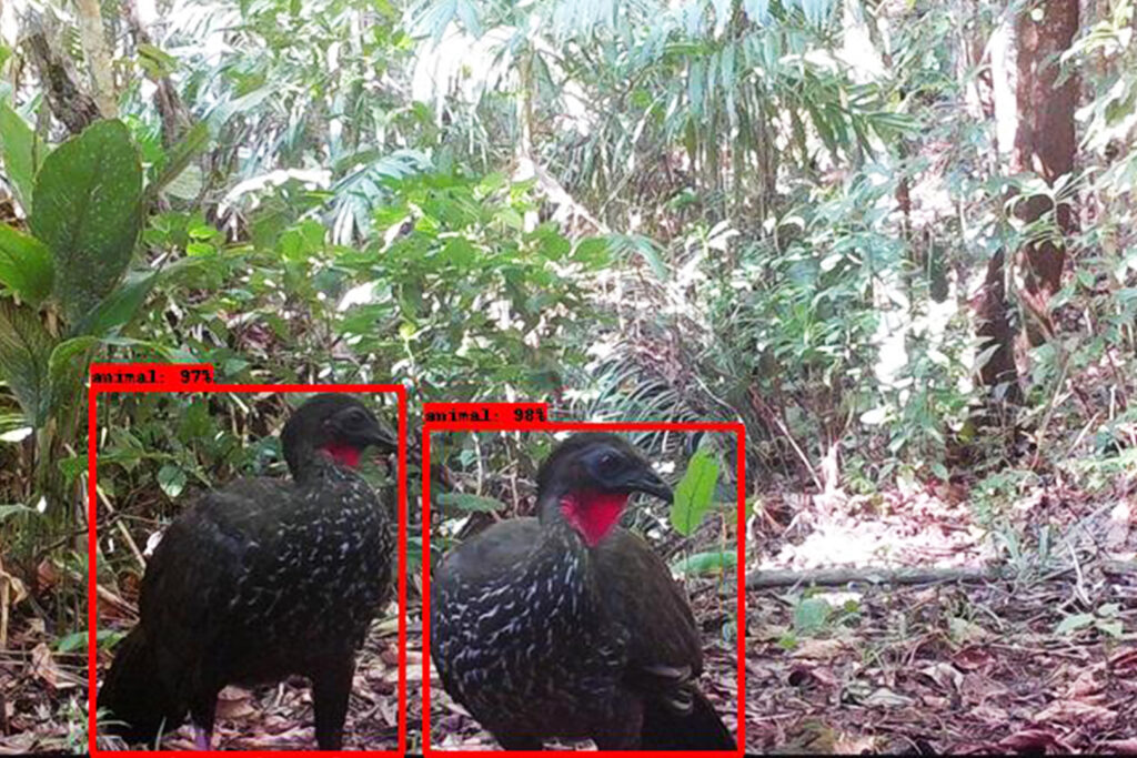
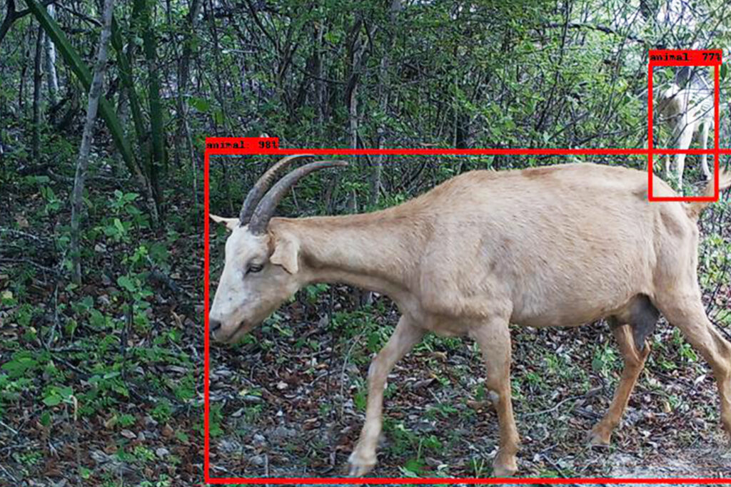
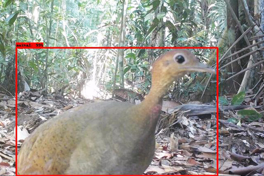
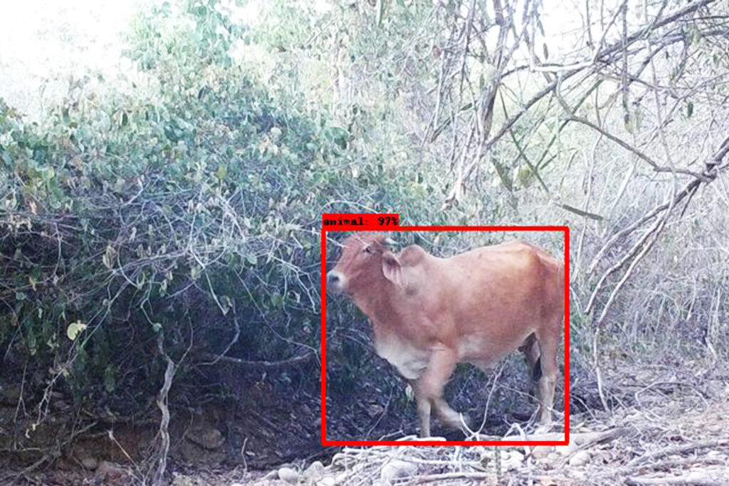
An animal skitters through the heavy underbrush of the Colombian forest in the dark of night. Hidden deep in the brush is a camera trap that quickly snaps a picture. An AI tool called MegaDetector identifies and classifies the results, streamlining a process that used to take days into minutes. The image is then sent to wildlife experts for review.
Could this picture of genus Dasyprocta, a rodent-like creature better known as an agouti, help solve the puzzle of deforestation that has plagued the Amazon for years?
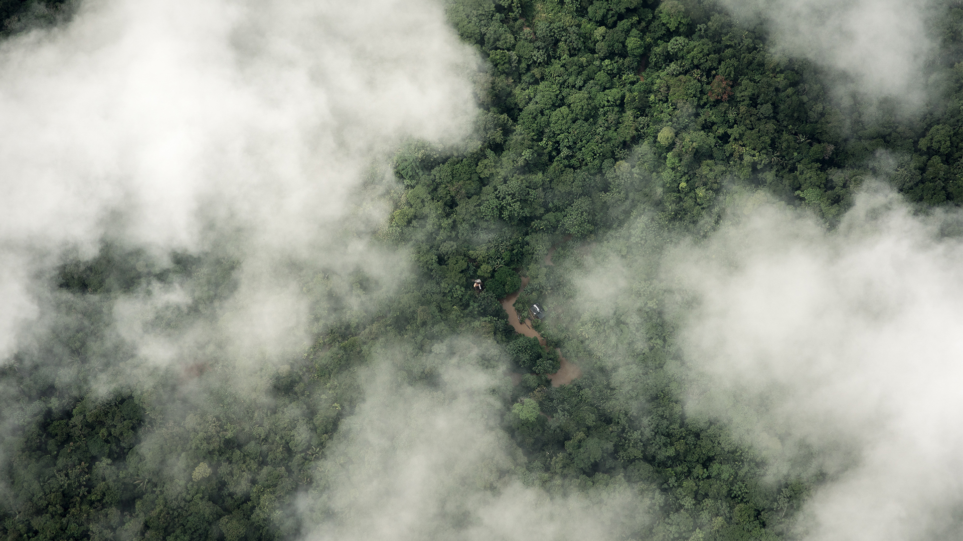
The Amazon is the world’s largest rainforest, in an area so vast it encompasses nine countries, including Colombia and Brazil. According to NASA’s Earth Observatory, it covers around 2.3 million square miles, or 6 million square kilometers of land. The Amazon’s importance to the overall health of the planet, by absorbing carbon dioxide, helping regulate weather patterns and providing a home for flora and fauna, can’t be understated.
Yet, deforestation remains an urgent problem. According to research by Amazon Conservation, nearly 2 million hectares (almost 5 million acres) of the Amazon were subject to deforestation in 2022, a 21 percent increase from the year before, as land is cleared for farming, cattle, or illegal mining operations. In Colombia, almost 1 million hectares of forest were lost in 2022, primarily in northwest areas like Caqueta. If deforestation remains unchecked, it could permanently skew the planet’s ecosystem, according to international environmental experts.
So how does anyone tackle a problem so large and complex as trying to reverse deforestation on a major scale? Enter AI. Thanks to the power of data, machine learning, cloud technology, data science and applied analytics, experts are developing innovative, collaborative programs that will make recognizing deforestation patterns easier and provide tools for policymakers to use in creating action plans that could stop deforestation in its tracks.
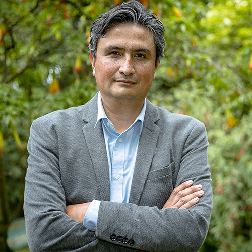
“We need to be using technology and innovation to think outside of the box to face the problems that we have,” said Diego Ochoa, director of external affairs at the Alexander von Humboldt Institute in Bogotá, Colombia. “We have powerful tools at hand to promote change in society.”
Ochoa and his team at Humboldt have joined forces with several other organizations in Colombia, including the CinfonIA Research Center at Universidad de los Andes, Instituto Sinchi and Microsoft AI for Good Lab to create Project Guacamaya, which uses best-in-class AI models to monitor deforestation and protect the biodiversity of the ecosystem. The algorithms developed allow information to be developed in a tenth of the time compared to manual analysis.
Project Guacamaya (MACAW in English) uses a mix of new AI models for satellite analysis, and modified AI models from existing projects within Microsoft for camera trap analysis and bioacoustics. The databases are stored in the cloud and the group is using the virtual machines and computational power of Microsoft Azure to design and train the models.
“If you think about one of the areas in the world that we need to save, it’s the Amazon,” said Juan Lavista Ferres, Vice President and Chief Data Scientist at Microsoft’s AI for Good Lab. “This project is not going to solve all the problems the Amazon has, but it is going to solve one I think is fundamental: You can’t solve a problem if you can’t measure it. By doing this, we can actually start measuring the problem.”


The multimodal AI project takes a three-pronged approach to monitor the Amazon and develop solutions, combining satellite data, hidden cameras and acoustic records to show aerial and terrestrial results, support Colombian conservationists and accelerate the pace of analysis. This helps all parties get a better picture of the ecosystem and develop critical reports to governmental bodies and conservation organizations that can then take steps to reduce deforestation.
“For instance, there is a public institution in Colombia called IDEAM that has the mission of constructing maps … that specifically localize deforestation each year,” said Pablo Arbeláez, director of the Center for Research and Formation in Artificial Intelligence at Universidad de los Andes. “They create by hand those results until perfect because this is used for the official statistic in Colombia for deforestation. They spend months of manual work for this method.”
“If we can produce models with 90 percent accuracy instead of 80, we reduce a months-long effort to weeks,” Arbeláez added. “Officials can make that information available to the public with a much shorter delay. That would be a game-changer, because, for instance, if you plan to implement a conservation project, you want to know how much carbon you capture in reforesting. You need that map to measure and convert the carbon you’re capturing. So, just for that purpose, this information is crucial.”
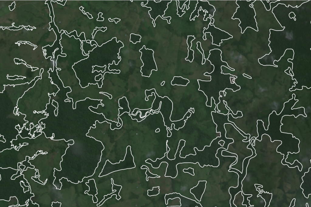
The first phase begins from high above, as satellites from the technology partner Planet Labs PBC provide daily high-resolution images of every single point on Earth. Project Guacamaya is developing AI models to quickly track these images over time, spotlighting areas where illegal deforestation or illegal mining is occurring. These satellite images allow the Colombian authorities and scientific organizations to easily track the Amazon from space – the literal definition of the bigger picture. One telltale signal that deforestation or mining is about to occur is the presence of unauthorized roads. If those are spotted in satellite imagery, authorities can be alerted to the activity.
“The capacity to analyze massive amounts of data is critical here because we know that it’s a rainforest that spans countries and millions of square kilometers,” Arbeláez said. “So, to have a global view of the Amazon basin, you truly need the power of AI and these new models.”
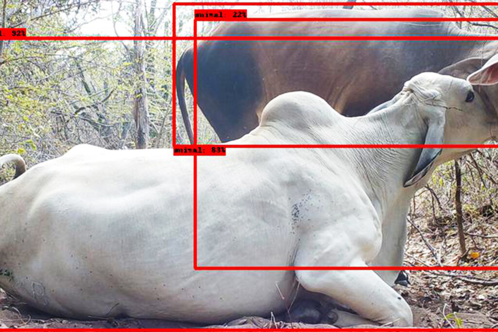
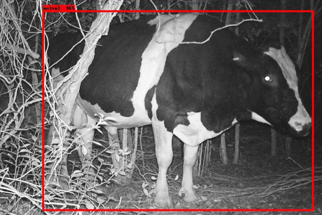
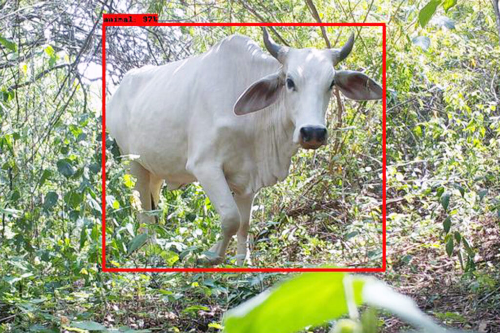
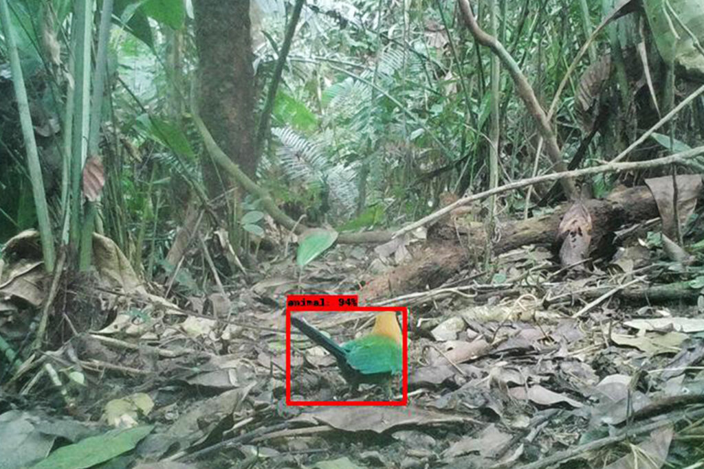
The next step is critical to the biodiversity of the rainforest. Camera boxes have been placed throughout the Colombian Amazon. Anytime the cameras see movement, they take a picture. A single camera can take up to 300,000 photos. But having a researcher flip through every single image would take years.
So, AI programs help speed up the process. The Department of Biological Sciences at Universidad de Los Andes contributed 110,000 images collected over the past four years. With the help of AI, researchers trained a model that detects which images contain animals and those that do not. Now, only 10 percent of images need to be manually validated, freeing up valuable hours for other research. Additionally, being able to quickly determine what images have been captured is key, because if something seems out of place, it could be a sign of ecological shifts that need to be addressed.
“It’s like a picture in time,” Ochoa said. “Monitoring allows us to see how plants and animals live and thrive. But if we see the wrong species in the camera, that is called a bioindicator. For instance, if we see a bird that is normally found in the savannah and is now in the Amazon, this is a red flag. We can say to the authorities, ‘We are getting information of a species that was previously not in this area. There is a change in the ecosystem.’”
“This technology, and the data it generates, allows us to inform decision-makers in the policy area to help us, especially when we are dealing with invasive species,” Ochoa added.
The final element of Project Guacamaya is sound. Using bioacoustics, researchers can capture sound from the Amazon and use an audio AI model to differentiate bird and non-bird sounds to classify bird and other animal species. Guacamaya consolidates more than 100,000 sounds into 1,000 recordings to have a baseline, and then trains a model to detect the different sounds and classify them. This helps scientists gain bird identification with reliability above 80%, which is a major milestone considering there are more than 2,000 bird species in Colombia.
“The use of this (technology) allows us to diminish the cost of the research in the field,” Ochoa said. “For someone to listen to biodiversity for three months, is something that no one can afford. This technology allows us to do that in a very cost-efficient way.”
Protecting the Amazon rainforest is a large-scale issue that no one organization or entity can tackle on its own. Collaboration is a critical part of Project Guacamaya, with numerous groups coming together to bring their own expertise to the table, and then hopefully create models that can be used throughout the country and the region for the greater good.
“Our goal here is to bring everyone in the same room and work jointly towards a common goal, because each of the partners and institutions can have a complementary role on the project,” Arbeláez said. “To protect the world’s largest rainforest from the effects of climate change, this needs to be a joint effort from all the countries that have a stake in the Amazon. We truly hope the region’s leaders and all our Latin America siblings will take this project as their own.”
In Brazil, where the effects of deforestation and mining in the Amazon have been most prominent, a collaboration between Microsoft, environmental organization Imazon and nonprofit Fundo Vale Foundation called PrevisIA is also addressing the problem using technology.
The PrevisIA platform uses Microsoft’s AI to analyze data and satellite images to forecast and monitor deforestation in Brazil’s Amazon. Imazon uses satellite images and then stores them in the Azure cloud, where AI algorithms detect unofficial roads and other risk factors of deforestation. The resulting output is visualized in an interactive map, highlighting the high-risk areas. This information is then used to support decision-making for safeguarding the rainforest.
“We use PrevisIA to anticipate the risk areas and implement actions to avoid deforestation,” said Carlos Souza, a senior researcher with Imazon. “When people go to the ground to do work, the forest is still there as opposed to getting the deforestation alert and going to the field to discover the forest is already gone. That’s the real motivation.”
As the data and results from Guacamaya and PrevisIA continue to grow and be refined, the goal is for other countries to replicate these projects to help protect the Amazon on their turf.
“All of the models we’re going to be doing will be open source,” Lavista Ferres said. “Ideally, once we finish these models, we can look at Ecuador, we can look at Perú and say, ‘We have this. Can we sync and see how you can use it?’ ”
In Colombia, the hope is that by showcasing the power of AI and presenting easily digestible data, the population will better understand the importance of protecting the Amazon for not only the present day but also future generations.
“One of the things we want to do here is a transformation of society,” Ochoa said. “We are a mega-diverse country, but our economy is based on the use of raw materials. The data and information that this project is generating is going to help our society be inspired by what biodiversity is.”
“This is not just about monitoring and it’s not just about artificial intelligence or even generating a scientific paper,” Ochoa pointed out. “We need to inspire society, and this kind of project, using technology, using innovation, using AI, hopefully will inspire Colombians to change the way they think about biodiversity and nature. This will help people get closer to what we have in those areas.”
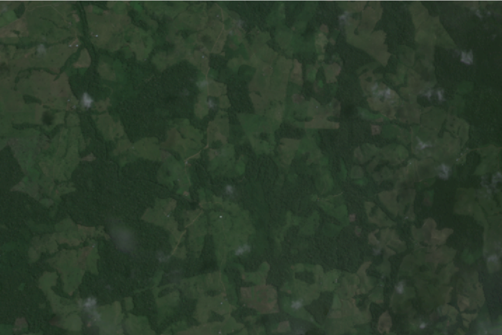
Top image: The Amazon is the world’s largest rainforest. However, in Colombia, almost 1 million hectares of forest was lost in 2022. Image by Wilfredo Amaya/Getty Images.