SpaceCows – using AI, space technology and cloud to protect the Top End
![]() Microsoft News Center
Microsoft News Center
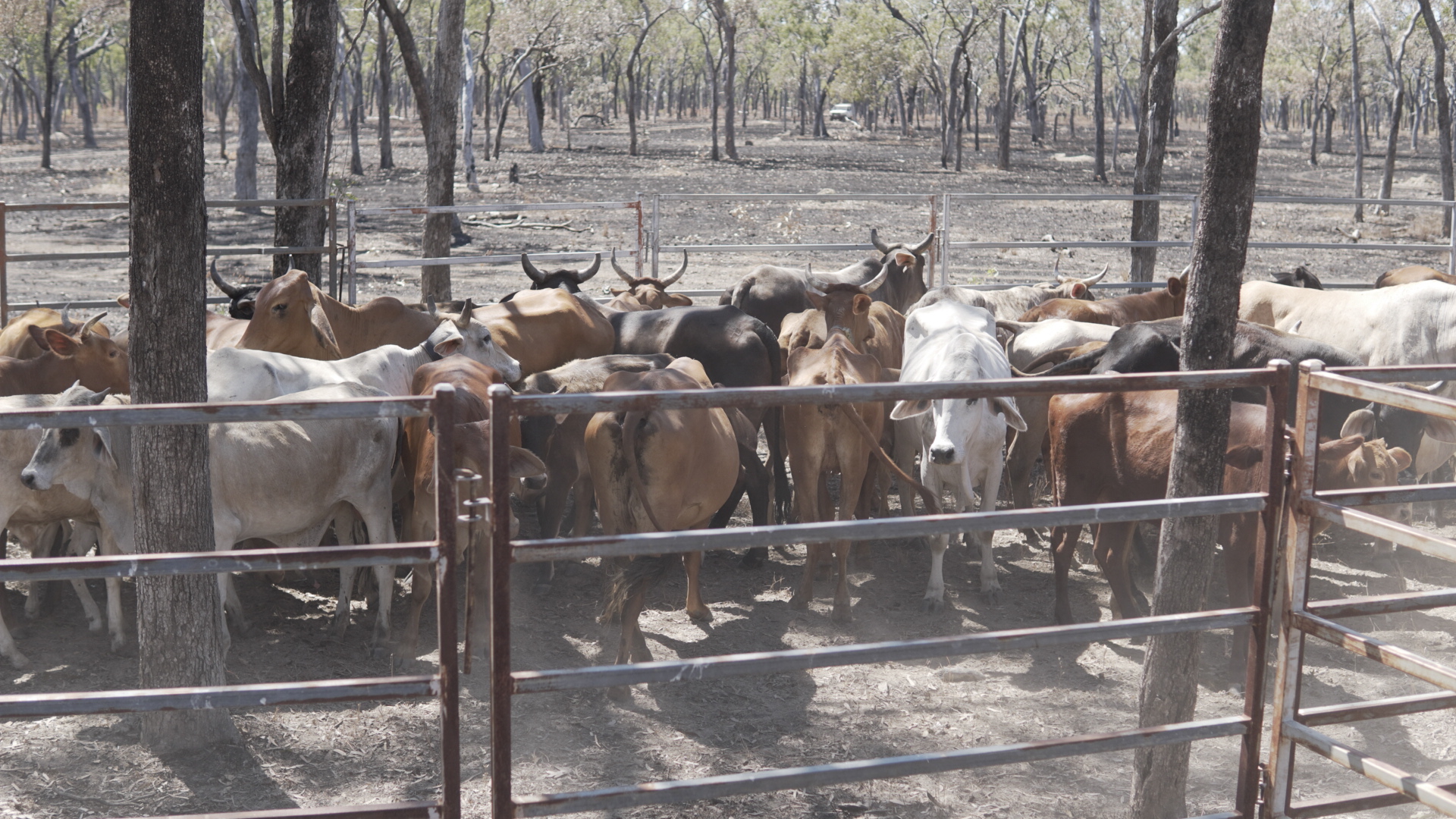
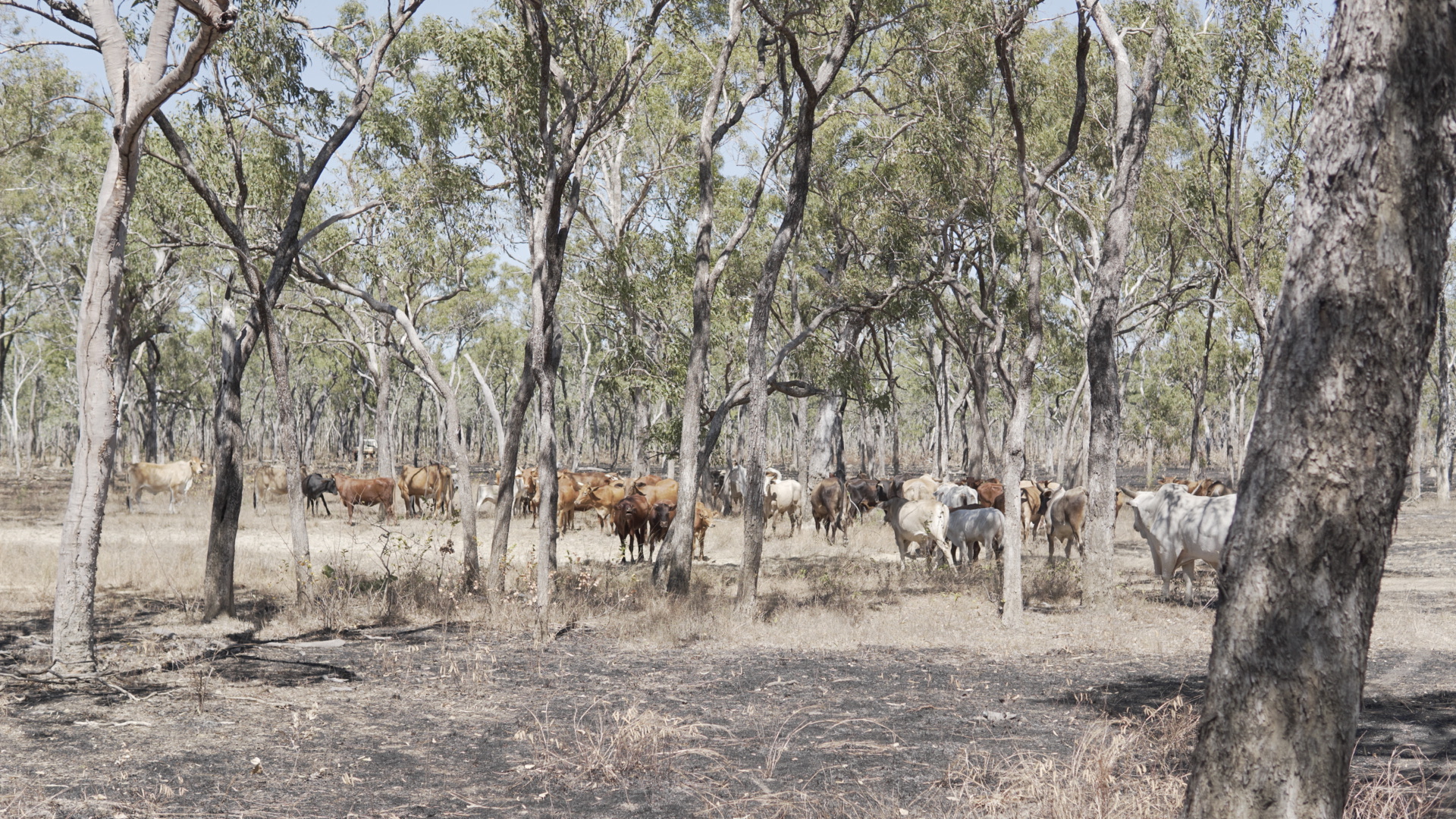
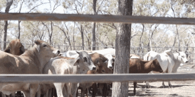
A feral buffalo can weigh 1,200 kgs (2,645 pounds) and stand 188 centimeters (6 feet 2 inches) at the shoulder. They are huge, unpredictable animals – and although Crocodile Dundee was able to stare one down in a movie, in real life they are far more dangerous to people and the environment.
Introduced by pioneer farmers in Australia’s far north in the 1800s, buffalo went wild in the mid-1900s when settlements were abandoned and stock was set loose.
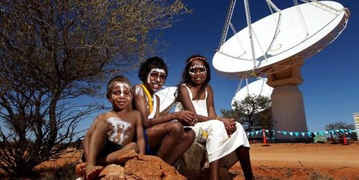
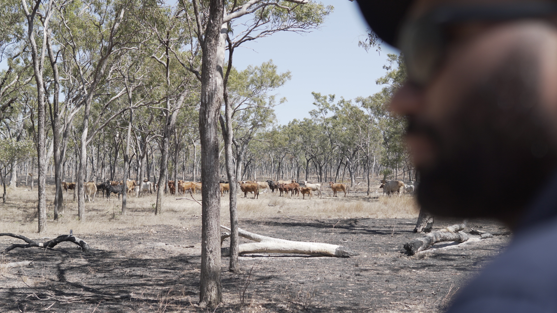
Today feral animals – both buffalo and cattle – are a major threat to the ecology and economy of Northern Australia, which is known as the Top End. Millions of dollars are invested in feral animal management programs – but a new approach is being investigated that brings together on the ground Indigenous knowledge, space technology and artificial intelligence with a goal to create the world’s largest remote herd management system.
Microsoft has been working with CSIRO on the groundbreaking initiative – developing AI algorithms and machine learning pipelines that will act as the digital foundations for the program. This is intended to build new economic, environmental and cultural opportunities as well as create evidence backed ‘best practice’ for managing large herds using AI and space technology.
The SmartHerd management program is a $4 million AUD ($2.9 million USD), four-year initiative led by Australia’s national science agency, CSIRO. SmartHerd will see more than 1,000 unmanaged cows and buffalos electronically tracked using GPS satellite tracking tags.
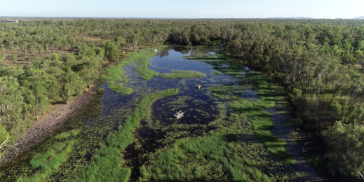
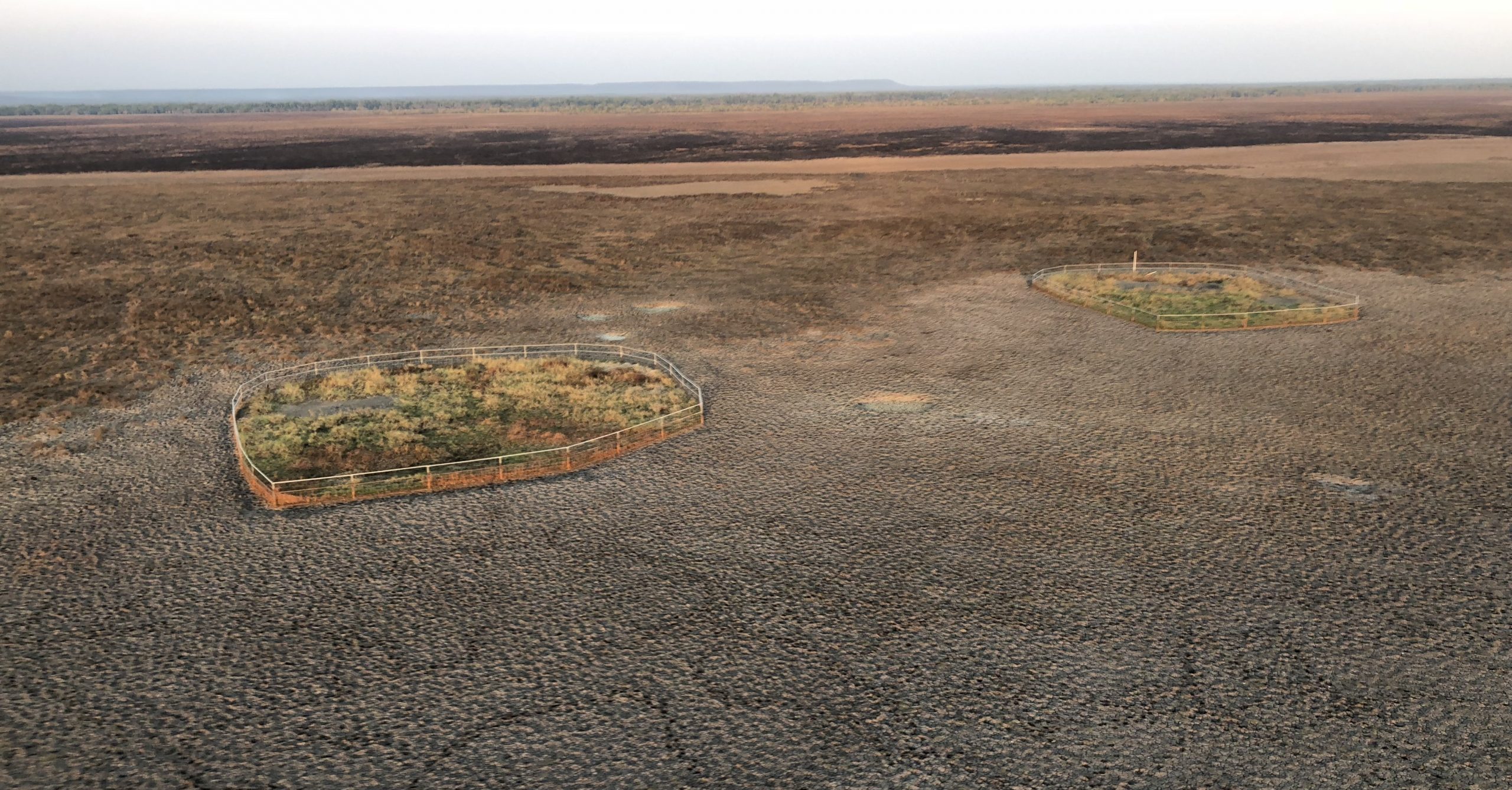
In a program dubbed SpaceCows, the animals will be tracked across a combined 22,000-plus square kilometre area, taking in the Arafura swamp catchment in Arnhem Land in the Northern Territory, and Upper Normanby and Archer River on Queensland’s Cape York Peninsula.
Instead of using conventional wireless technology, which does not lend itself to the natural topography and harsh environment in Australia’s far north, tag data will be collected using Kinéis’ 25 nanosatellites IoT constellation, at 650 km of altitude and Microsoft Azure.
Artificial intelligence will interpret the data and provide forecasts to Indigenous rangers using Power BI dashboards. This will allow the rangers to take targeted actions to control problem animals in order to protect the environment and important cultural sites. This approach also creates economic opportunities by enabling the ethical harvesting and sale of feral livestock.
An extension of the Healthy Country AI partnership with CSIRO, which has already helped protect Magpie Geese in Kakadu National Park and endangered turtles nesting on Cape York, the SpaceCows project is a partnership between CSIRO, Microsoft the North Australian Indigenous Land and Sea Management Alliance (NAILSMA), satellite IoT company Kinéis, James Cook University, Mimal Land Management Aboriginal Corporation, Aak Puul Ngangtam, Normanby Land Management and Charles Darwin University.
Ethical approach
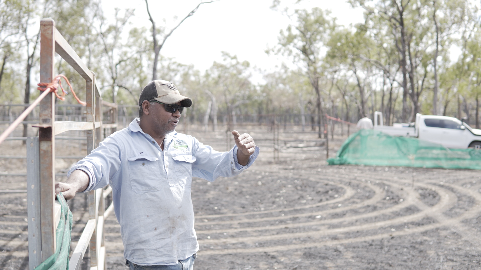
The project is supported by the Smart Farming Partnership initiative, through funding from the Australian Government’s National Landcare Program and focusses on creating a roadmap to help the administration of unmanaged herds on indigenous lands. Besides supporting on-ground local capability in the ethical mustering and handling of feral cattle and buffalo the program will develop an accredited training and education program, expanding the digital skills and on-country employment opportunities for indigenous people.
Dr Andrew Hoskins, research scientist, CSIRO says; “The key to doing this efficiently and cheaply is to use a satellite-based radio technology.
With our technology partners, we’re building satellite linked ear tags that then send through location, activity, temperature, humidity, a few other bits of metadata, and then backhaul that information through the Kinéis satellite IoT system.
Key to the success of the SpaceCows initiative are decision support tools which will be designed to support efficient mustering and to account for environmental, cultural and economic values.
Hoskins says this will require environmental data from an array of remote sensing data sources to be interpreted in order to fully understand how herds move across the landscape. Armed with that insight CSIRO wants to develop a near-casting tool that allows people to propose different management scenarios and be able to get a feel for the cost and return of each of those scenarios.
It’s a massive undertaking with enormous long-term promise, and the first phases of work are well advanced.
Digital foundations
CSIRO and Microsoft have been working on the AI algorithms and creating machine learning pipelines, as well laying the foundations for the underlying digital platform for SpaceCows.
To train the system Microsoft and CSIRO have been using data from an earlier project that over 18 months tracked the movement of 22 feral buffalos in Arnhem Land.
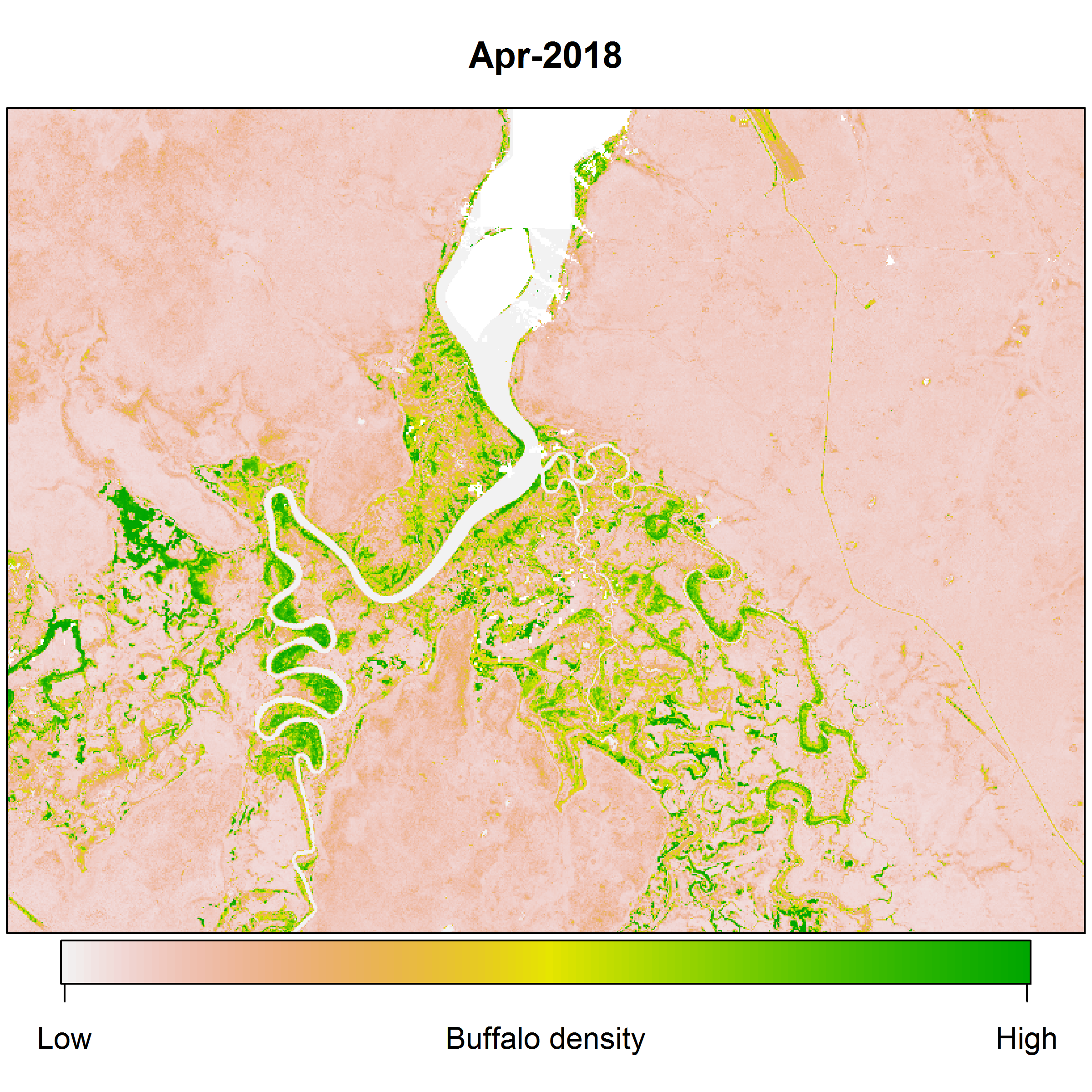
Using the animal movement data to create observed distributions, and then intersecting that with environmental data, including weather, has allowed the development of a series of models that reflect the data.
CSIRO is confident that the work it has done with the test data will be able to scale once the 1,000 cattle are tagged in the SpaceCows project.
Erin Graham, a researcher with CSIRO, adds that Azure’s geographic reach is important to support the scientists involved in the program who are based right across Australia. Azure also supports Microsoft’s space engineers based in Canberra and Adelaide, who have been working to find a way to scrub clouds out of satellite images that could otherwise obscure terrestrial detail needed for the project.
According to Lynn McDonald, Azure Space Lead, Microsoft Australia; “This is an important example of how greater access to space-enabled technologies can have a positive effect on critical environmental challenges in Australia.
“Azure Space is focused on making connectivity and data from satellites increasingly accessible for our customers across industries including agriculture, energy, telecommunications and government. Azure Space includes an array of Azure technologies, services, and innovation tailored to the needs of the space community and its customers.”
Steve van Bodegraven, AI for Environmental Intelligence and Monitoring, Microsoft Australia explains that Azure Machine Learning, Azure Synapse Analytics and Azure Blob storage combine to create the digital foundations for the SpaceCows program while the project also leverages the learnings of the Healthy Country AI program. He adds:
It is a pioneering program that’s mixing responsible AI and science with indigenous led knowledge and solving complex environmental management problems at spots in Northern Australia.
In the future, the learnings from this program of work could feed into other initiatives designed to address other feral animal challenges posed by donkeys, goats and pigs.
Researchers are also exploring how Microsoft’s Planetary Computer capability which combines global environmental data with intuitive APIs could help expedite the development of on-the-ground solutions.
Graham explains that in this application; “We want to be able to deploy to rangers on the ground so that they can make near real-time decisions. Having everything in Azure definitely assists with that.
“Plus it’s very robust in terms of what it’s integrated with. So it talks to the tools that we’re already using, Git repos and our statistical package Universe … so that makes things a lot quicker to develop and more flexible for us.”
Azure also has no problem with the computational intensity of the project – for example developing vegetation indices that reflect how thickly or sparsely vegetated an area is – important insights for both predicting cattle movement and planning Ranger actions. The indices are calculated using a huge database of almost 200 gigabytes of raw data which has been successfully ingested into Azure.
This sort of deep analysis is fundamental to the creation of a digital twin of the landscape that CSIRO will leverage to help rangers manage feral cows and buffalo in the Top End.
Indigenous agency
Graham says that models have already been developed using the sample data which shows how individual buffalo move around – typically five km a day, though only one km as the crow flies. “Eventually we’d like to get to using the data to predict distributions of the entire herd. And a time series of where the herd might be at different times in the year,” she adds.
Hoskins says the focus will next shift to the user experience for people that interact with the data and models so that the system delivers useful information.
According to Graham; “We can overlay with other data sets. So for example when the rangers are looking to muster, they not only want to know where the herds are, but they want to know, can we get there? Is there a flat area nearby where we can set up fences for mustering? Can the trucks get there to bring the animals out? Can the rangers get there to capture them? Are there enough animals there to make it cost-effective to get there?”
Once that level of detail can be served up to rangers via a simple to use Power BI dashboard it will be possible to schedule ethical and economical harvesting expeditions that reduce the environmental and cultural toll of the feral cattle and buffalos, and also create economic opportunities for local communities to sell the harvested animals.
Local communities would also be able to prioritise Ranger activity through their understanding of the threat that feral animals pose to the local environment and important cultural sites.
Hoskins adds that; “The dream is to have decision support tools set up so that the backend runs fast enough and does the analytical processing fast enough so that you can have someone sit there and look at this visualisation of their property and say, ‘Well, what happens if I try my mustering out here? What happens if I do this here or move things around in this way? What are the likely outcomes?’
“That’s where we’re talking about the scenario tools, because the one thing we don’t want to happen with these tools is for them to be something that just tells people that this is where you go, and this is what you do. Because that doesn’t work.
That never works on the ground, that doesn’t allow you to bring in the unique experiences that the land managers who work on the land have of their property and how things may work.
Ensuring that the agency of rangers and local communities is respected and preserved is critical to the sustained success of the program. The Power BI dashboards will provide them unprecedented insights about the movement of feral animals and their best opportunities to manage them – but the final decision making will be left to rangers and local communities.
Local people will also be encouraged to add extra on-the-ground data and insight to the project that will ensure that the digital twin is fully optimised and delivering to its fullest potential.