CIRC’s intelligent drones help volunteers watch over a vital water resource in Taiwan
You-You Wang leaves his home in the Taiwanese city of Taoyuan at around 6 a.m. He makes a quick stop nearby, picks up his friend Hongzhi Li and then drives south into the foggy countryside.
Both men retired from military service years ago. But today, like most days, they’re back on dawn patrol.
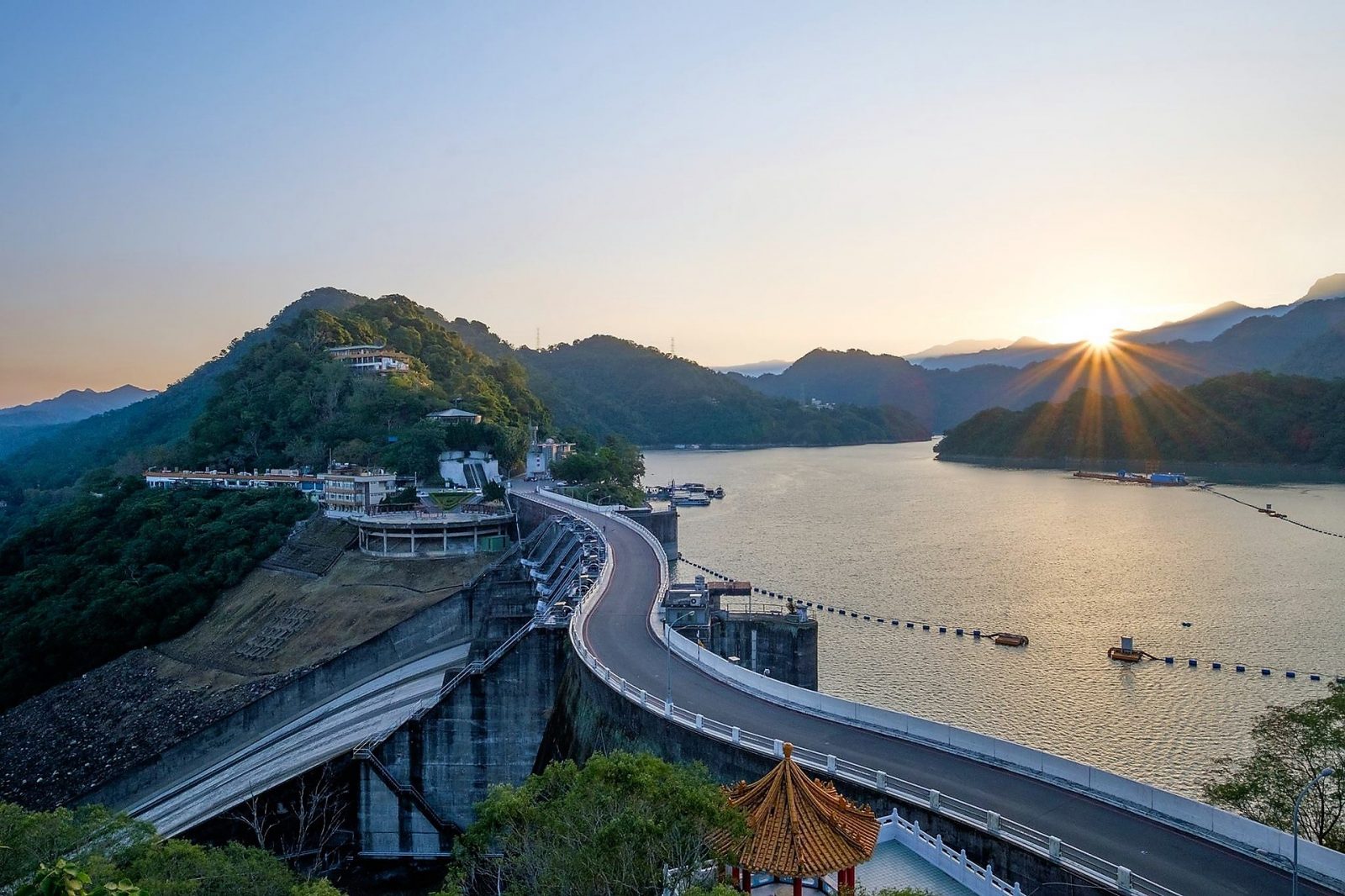
Their destination is about an hour out of town: the Shihmen Reservoir and Dam. And their mission is to watch over the environment around it. They do this in their car, on foot and with the help of drones and cloud technology.
The Shihmen Reservoir is one of Taiwan’s most important sources of water, not just for millions of citizens, but also for the island economy’s world-leading semi-conductor factories that consume millions of liters (gallons) a day.
Wang and Li are among 135 volunteers recruited by the reservoir’s authorities — the North Region Water Resources Office (NRWRO). The volunteers’ task is to look out for signs of illegal farming, pollution and other illicit activity that might damage Shihmen’s protected catchment area of 763.4 square kilometers (294 square miles).
The group is eager and energetic. They happily spend up to nine hours a day bumping along unpaved roads in their vehicles and trekking on foot up and down hilly terrain.
But with so much rugged territory to cover, it’s been a challenge to track down wrongdoers. That’s why they have turned to technology.
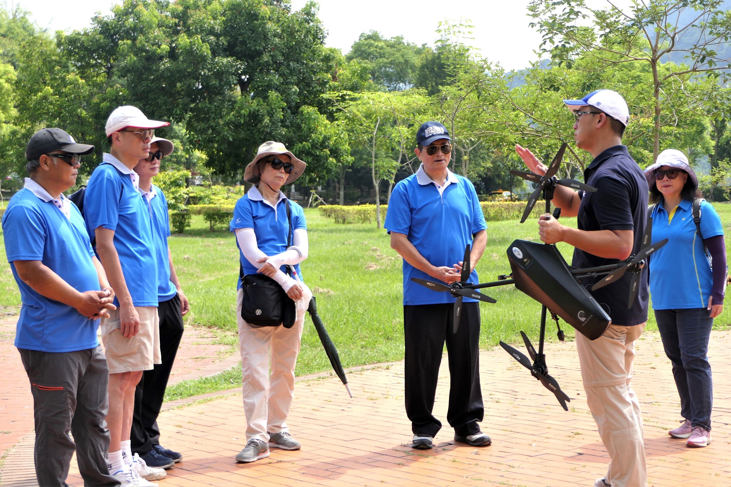
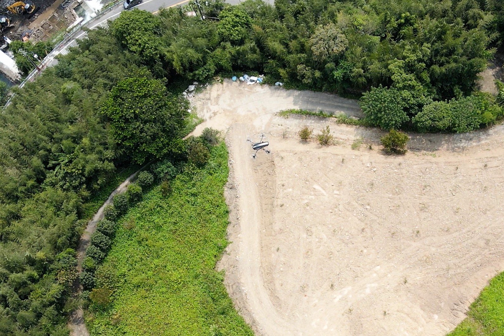
Their daily ground patrols are now augmented by intelligent drones that fly over and photograph the area at around 120 meters (393 feet) up.
A 20-minute flight typically covers around 200,000 square meters (49.4 acres) and results in thousands of high-definition images.
Cloud-based solutions process the image data and scan for signs of suspicious activity and map its location.
The volunteers on the ground move in quickly and investigate when anything suspicious is detected.
“Previously, we were recording two to three cases of illegal activity per month,” says Yu-Jia Chiu, who helps NRWRO manage the reservoir’s watershed and the volunteers. “After implementing the drone solution, we’re recording more than 10 cases a month. It’s monumental progress in protecting one of our most important water sources.”

Water from Shihmen is distributed to 28 districts in the cities of Taoyua and Hsinchu as well as the capital, Taipei.
Overall, the reservoir supplies 3.4 million people across northern Taiwan, irrigates more than 36,500 hectares (90,000 acres) of legal farmland and generates hydroelectric power.
Having reliable supplies is also crucial to Taiwan’s thirsty semi-conductor sector, which manufactures around half of the world’s chips that are used in everything from automobiles to home appliances, to smartphones, PCs and so on.
The industry consumes an estimated 7.5 million to 34 million liters (2 million to 9 million gallons) of water per day.
Most of the time, that’s not a problem as a series of typhoons usually dumps huge amounts of rain over Taiwan annually. Last year, however, there were no big downpours and the island suffered its worst drought in 56 years. When reservoir storage capacities fell below 20%, authorities stepped up security and sustainability measures to safeguard supplies.
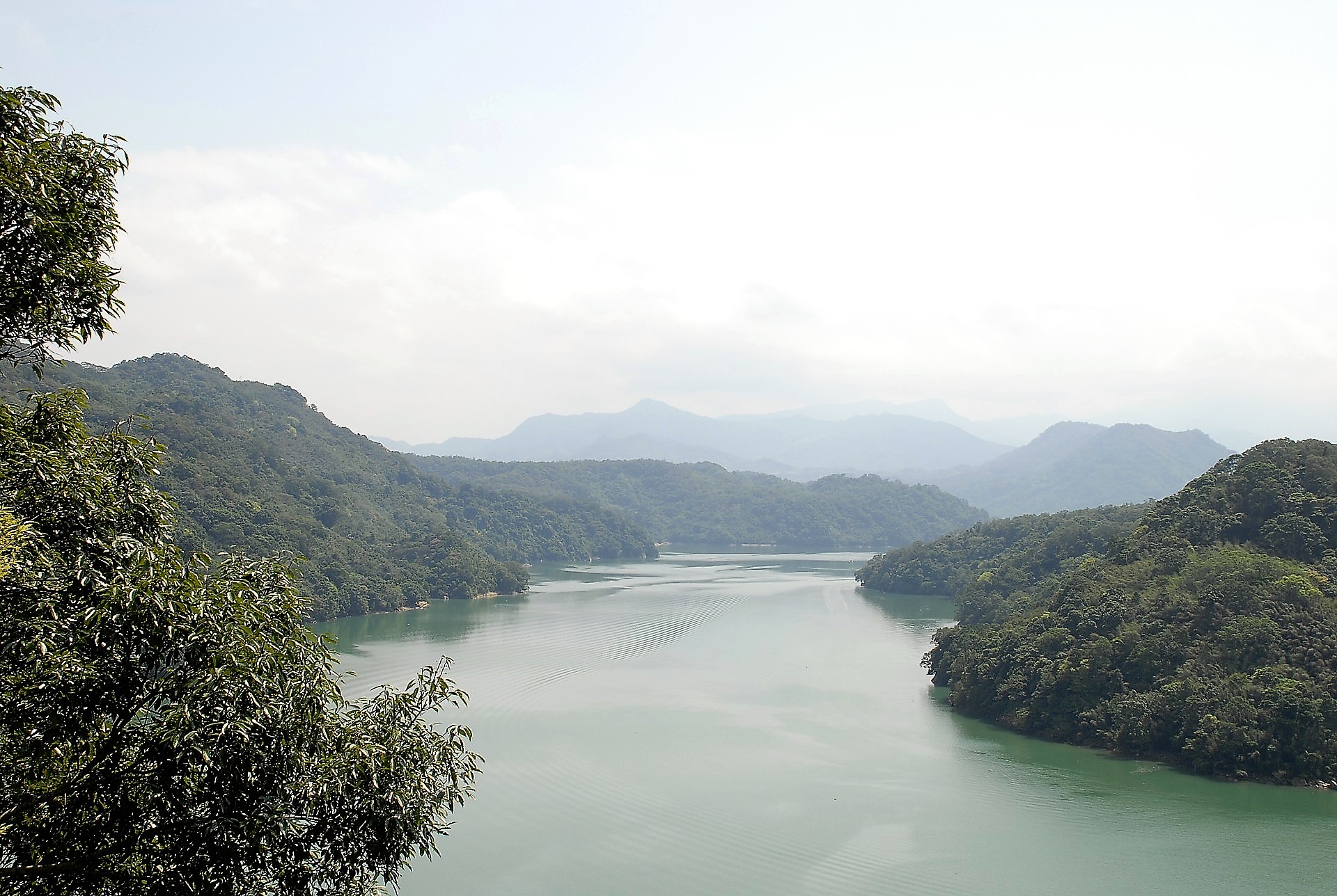
The Shihmen Dam holds back a large lake set against a backdrop of breathtaking mountains. Its views and outdoor activities bring in thousands of tourists and day trippers.
But it also attracts the wrong kind of visitors. Nearby villagers and city dwellers have been illegally growing fruit and vegetables on the steep slopes above its shore. Plowing the land and tree felling can trigger landslides that spill into the reservoir, muddying the water and adding to a growing threat of sedimentation in the reservoir. Illegal campers also leave behind trash and fire pits that smolder dangerously in the forest.

Taiwanese robotics firm, Coretronic Intelligent Robotics Corporation (CIRC), developed Shihmen’s drone solution, which leverages the cloud computing power of Microsoft Azure Cosmos DB to scale elastically with fluctuating amounts of real-time data.
Drone data is stored and analyzed in Azure IoT Hub while an IoT solution called SkyWatch produces a real-time dashboard for each flight.
Another CIRC service, the Insight Data Analytical Platform, achieves data analysis and forecasting through machine learning, 2D and 3D geographic modeling, visualization, and aerial imagery analysis.
As well as optimizing task management and system maintenance based on historical batch data analysis, it can also make damage predictions for disaster prevention through Azure SQL Database and Azure App Services.
CIRC supplies security drones to industries that need to monitor hard-to-reach or restricted areas.
“We specialize in smart inventory and security,” says Andy Shin, General Manager of CIRC. “Smart means you don’t need people to remotely control the drones. Just schedule the mission’s details into the computer and the drone will automatically take off and come back to the station with a pool of data.
“The drones use Azure’s AI to distinguish structures that look like illegal farms, reading boundaries and calculating the size of structures it photographs. It then maps these images against historical data, allowing Dr. Chiu and the team to learn, for instance, if a building was recently constructed or has expanded in size. It’s a weapon for environmental sustainability and a tool for empowering frontline workers.”

Volunteers Wang and Li are all in favor of the drones.
“The reservoir provides water to us and our families, and millions of people in Hsinchu, Taoyuan and Taipei. We have a responsibility to protect it,” Wang says. “But finding illegal activity here has been like looking for a needle in a haystack.
“Now with the intelligent drones, we can pinpoint the location of perpetrators and catch them within minutes, instead of days. It’s like a lighthouse shining a light for a ship lost at sea.”


